

Wednesday's Weather Outlook
The new month is off to a warm, wet, and wild start for much of the country as July starts to heat up.
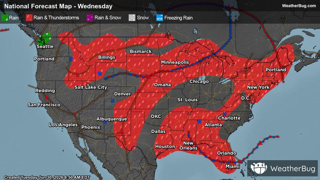
The U.S will face several patches of stormy weather this Wednesday thanks to multiple disturbances.
Early in the day, scattered cloud cover, showers, and thunderstorms are expected in portions of the Northern Mountain West, the Desert Southwest, Great Plains, Upper Midwest, and the East.
In the afternoon hours, activity will become more widespread, which is typical for this time of year. Storms will fire up across the Plains, Upper Midwest, Northeast, and Southeast. There is a severe weather threat associated with these storms, especially in the Upper Midwest, where these storms may produce damaging winds, hail, and even tornadoes. Remember, the best way to stay safe is to be prepared and informed about your local weather, such as checking the WeatherBug app for any weather updates and that “When Thunder Roars, Go Indoors!”
Isolated showers may occur throughout the day in the Pacific Meanwhile, the rest of the country is expected to be high and dry, with clear or partly cloudy start of the month.
In the East, a heat dome is starting to build, with highs in the 80s and 90s, where some spots may even hit the triple digit mark. Meanwhile, the Pacific Northwest and Mountain West will see highs ranging from the 60s to the 80s. Areas of higher elevations can expect even cooler temperatures, with highs only in the 40s and 50s. In the Desert Southwest, along with western Texas and much of the Plains, highs will be in the 90s, however, some areas will surpass 100 degrees.