
Today's Weather Outlook
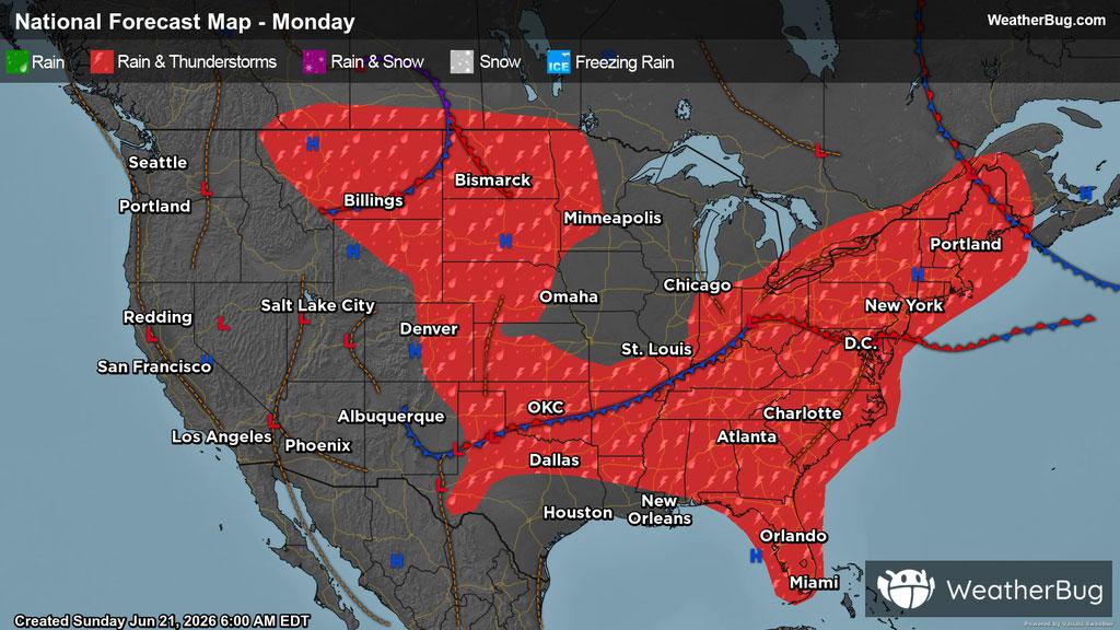
The workweek will be off to an active start for much of the Eastern and Central U.S. while the rest of the country remains dry.
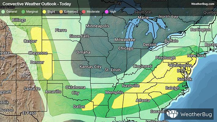
The Eastern, Southern, and Central U.S. can expect cloudy skies along with scattered showers and thunderstorms, where a few storms may be severe. This is especially the case in the Western Plains, where storms will fire up in the afternoon hours.
Lower Appalachia through the Mid-Atlantic will also be prone to thunderstorms, which will move east throughout the day. The biggest threats associated with these storms will be hail and damaging winds. The best way to remain safe is to stay prepared and informed about your local weather. Remember, "When Thunder Roars, Go Indoors!"
Limited atmospheric moisture, along with a ridge building up out West will keep much of the region calm. Here, anticipate for the most part to stay high and dry, with clear and partly cloudy skies. Similar weather is expected in a portion of the Midwest, with much of Missouri, Illinois, Iowa, Wisconsin, and Michigan staying dry today.
Cooler temperatures will continue to persist across the Northeast and Midwest, along with the Central and High Plains, where high temperatures will be in the 60s and 70s. Meanwhile, the lower Mid-Atlantic down through the Southeast can anticipate highs be in the 80s and 90s.
The Western U.S. will see great variations in high temperatures, ranging from the 80s to over 100 degrees, where much of the latter will be seen in the Desert Southwest, in addition to western Texas and the Southwestern Plains. However, In the Mountain West, regions of higher elevations can expect temperatures in the 50s and 60s. Throughout the country, there could be fluctuations in localized areas.