Back to forecast
Dorian Loses Tropical Characteristics, Still Battering Eastern Canada
December 17, 2019 at 10:02 PM EST
UPDATED By WeatherBug Meteorologists
Dorian lost its tropical characteristics last evening, but is still dangerous as it tracks across Newfoundland today. Heavy rain and wind will continue to buffet the Canadian Maritimes.
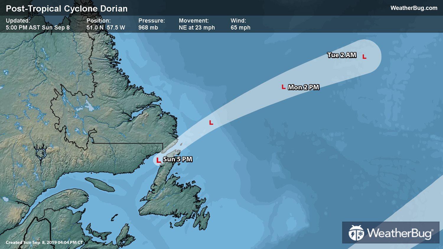
As of 8 p.m. EDT, the remnants of Dorian are still producing maximum sustained winds of 60 mph as they moves northeast at 23 mph. The system will pass over Newfoundland this afternoon, heading offshore and away from any other land masses this evening.
As of 8 p.m. EDT, the remnants of Dorian are still producing maximum sustained winds of 60 mph as they moves northeast at 23 mph. The system will pass over Newfoundland this afternoon, heading offshore and away from any other land masses this evening.
Tropical Storm Warnings are in place for Cape Anguille to Fogo Island, Newfoundland, and from Mutton Bay, Quebec, to Mary's Harbour, Labrador, on the mainland.
Nearly a half-million people are without power after the storm made landfall near Sambro Creek, Nova Scotia, yesterday afternoon. The fast movement of the storm will limit the rainfall potential as it advances toward Newfoundland, but the winds will wreak havoc as they are slow to drop off. On Friday, Dorian slammed the Outer Banks with wind gusts approaching 100 miles per hour.