Back to forecast
Central Plains At-Risk For Severe Weather Tonight
October 12, 2023 at 11:50 PM EDT
UPDATED By WeatherBug Meteorologists
A dynamic, large, and powerful low pressure over the central U.S. is leading to active weather tonight. As the low pressure system churns over the central Plains, robust thunderstorms will blitz across parts of the Plains and Mississippi Valley.
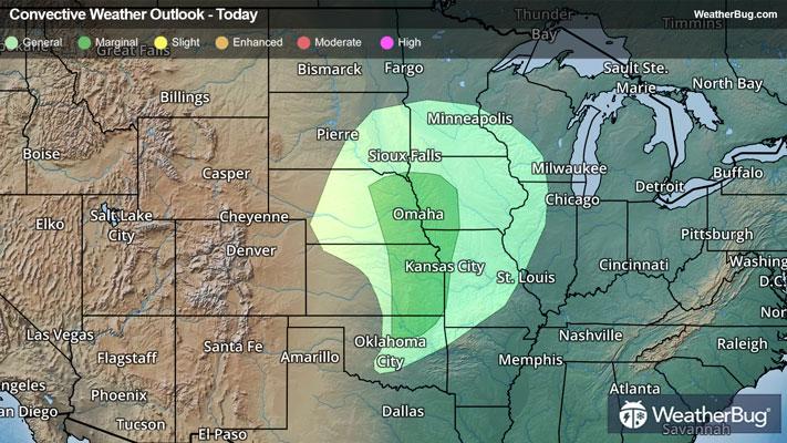
The risk of severe weather includes parts of the central Plains and Mississippi Valley. The strong low pressure system over the Plains will send a cold front sweeping through the unstable environment over parts of eastern Nebraska, western Iowa, northwestern Missouri and northern Kansas. This is where the Storm Prediction Center has placed a Marginal Risk for severe weather.
Cities such as Omaha and Lincoln, Neb., are at-risk of seeing thunderstorms producing gusts exceeding 50 mph and hail greater than 2 inches in diameter. Cities such as Wichita and Topeka, Kan., and Kansas City, Mo., will also want to keep an eye out for any rapidly deteriorating conditions.
Regardless of location, it’s best to make sure you know the difference between a watch and a warning should any be issued today. A watch means that conditions are favorable for severe weather to occur, and you should have a plan in place for acting. On the other hand, a warning means that severe weather is imminent, and you will need to act fast to protect yourself, family, friends, pets and/or property.
Remember, “When Thunder Roars, Go Indoors” and “Turn Around, Don’t Drown” should conditions rapidly deteriorate.