Back to Fire Alerts
Today's Weather Outlook
June 21, 2023 at 06:13 AM EDT
By WeatherBug Meteorologist, Alyssa Robinette
Today is the “official” start of summer and Mother Nature plans on bringing soggy, stormy weather to most of the nation. Wide ranging temperatures are also in the forecast as some see cooler than normal temperatures, while others bake in early summer heat.
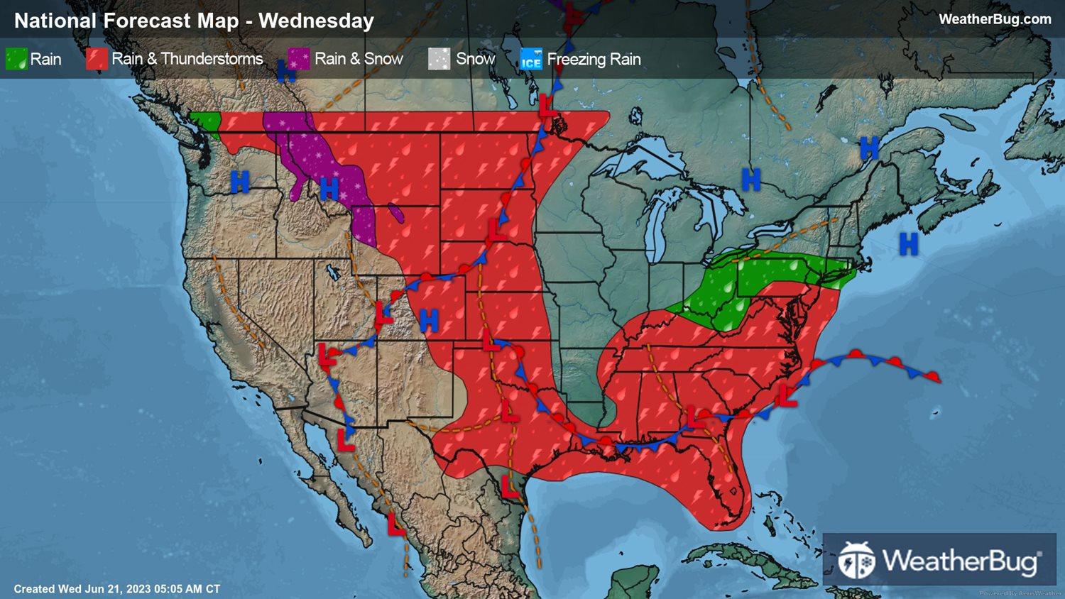
A stalled front will remain draped from the southern Plains into the Southeast today, while a warm front slowly creeps north across the Mid-Atlantic. Rain and thunderstorms will be found along both fronts throughout the day. Some rain could also make it as far north as New York City late in the evening.
Strong to severe thunderstorms cannot be ruled out, mainly across Florida. The main concern though will be the potential for repeated, slow-moving rounds of moderate to heavy rain. Most areas in the Deep South and Southeast have seen soggy, stormy weather the past several days, so the soil is already saturated and many rivers, creeks, etc., are running high. Be on the lookout for areas of flooding, especially in urban, low-lying and other more flood-prone areas.
A second stalled frontal system will hover over the north-central U.S. into the Front Range and central Rockies. Rain showers and thunderstorms will also be in the forecast here, though the afternoon and evening will see the best chance for any precipitation. There will also be a better chance for dangerous thunderstorms throughout the Front Range and High Plains. Destructive winds and large hail will be the main threats, but an isolated tornado or two is still possible.
Some showers will be possible across the Northwest and northern Rockies, with wet snowflakes or a rain/snow mix in the tallest elevations.
Dry weather is expected for a few areas during the middle of the work week. This includes California into the Great Basin and Southwest as well as the Great Lakes, Midwest and interior New England.
Unseasonably cool weather is expected for both coasts, while most of the nation’s midsection bakes under an early summer heatwave.
The higher elevations of the Mountain West will only see temperatures reach the 50s and 60s, while 70s and 80s await the Northwest, most of California, the Great Basin, Rockies and northern and central Plains. Sixties and 70s will also cover most of the Eastern Seaboard. Expect 80s and 90s throughout the Mississippi Valley, Great Lakes and Midwest, with 100s to even a few 110s in the Desert Southwest and southern Plains.