


Back to forecast
Unsettled Weather Returns to Great Lakes, Ohio Valley
August 24, 2023 at 12:28 AM EDT
UPDATED By WeatherBug Meteorologists
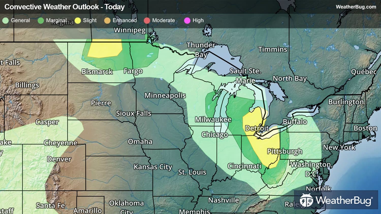
A disturbance and its fronts could trigger pockets of severe storms through midweek.
As the storm system moves into the Great Lakes, heat and moisture levels increasing along a warm front will generate scattered thunderstorms in Michigan, Ohio, western Pennsylvania, and western New York. This includes Detroit and Cleveland, which are within the Storm Prediction Center's Slight Risk.
Another round of intense thunderstorms are developing this evening across Michigan and are expected to continue into the Ohio Valley and even parts of Pennsylvania overnight. Some of these storms can organize into clusters and broken lines, with the potential to produce damaging wind gusts and hail. A tornado or two could also develop.
The cold front associated with this disturbance will slowly sag southward through the Midwest on Thursday and Friday, generating addtional storm activity each day. Isolated severe storms could form across the Lower Great Lakes and into the Ohio Valley on Thursday.
Another Slight Risk has been issued for northern North Dakota as a storm complex moving down from Canada may trigger thunderstorm development later this afternoon and evening. Large hail will be the primary threat but isolated damaging wind gusts and a tornado are also possible. Minot, N.D. is included within the risk area. A Severe Thunderstorm Warning remains in effect for central North Dakota, with the city of Harvey included.
Make sure to know the difference between a watch and a warning should they become issued. A watch means that conditions are favorable for severe weather to occur and to be on alert for any rapidly changing conditions. A warning means that severe weather is imminent, and you should act fast to remain safe.
The best way to remain safe is to stay prepared and informed about your local weather. Have a severe weather kit packed with a battery-operated radio, water and non-perishable food items should you be without power for long periods of time. Also, check the WeatherBug app frequently for any updates on today's severe weather. Remember, “When Thunder Roars, Go Indoors!”
As the storm system moves into the Great Lakes, heat and moisture levels increasing along a warm front will generate scattered thunderstorms in Michigan, Ohio, western Pennsylvania, and western New York. This includes Detroit and Cleveland, which are within the Storm Prediction Center's Slight Risk.
Another round of intense thunderstorms are developing this evening across Michigan and are expected to continue into the Ohio Valley and even parts of Pennsylvania overnight. Some of these storms can organize into clusters and broken lines, with the potential to produce damaging wind gusts and hail. A tornado or two could also develop.
The cold front associated with this disturbance will slowly sag southward through the Midwest on Thursday and Friday, generating addtional storm activity each day. Isolated severe storms could form across the Lower Great Lakes and into the Ohio Valley on Thursday.
Another Slight Risk has been issued for northern North Dakota as a storm complex moving down from Canada may trigger thunderstorm development later this afternoon and evening. Large hail will be the primary threat but isolated damaging wind gusts and a tornado are also possible. Minot, N.D. is included within the risk area. A Severe Thunderstorm Warning remains in effect for central North Dakota, with the city of Harvey included.
Make sure to know the difference between a watch and a warning should they become issued. A watch means that conditions are favorable for severe weather to occur and to be on alert for any rapidly changing conditions. A warning means that severe weather is imminent, and you should act fast to remain safe.
The best way to remain safe is to stay prepared and informed about your local weather. Have a severe weather kit packed with a battery-operated radio, water and non-perishable food items should you be without power for long periods of time. Also, check the WeatherBug app frequently for any updates on today's severe weather. Remember, “When Thunder Roars, Go Indoors!”