


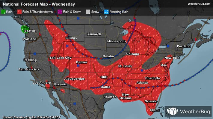
Winds and Hail Fall Across Central U.S.
Severe storms will romp again across multiple corners of the central U.S. today.
Starting in the High Plains, with the help of upper-level energy overhead and instability just above the surface, afternoon and evening thunderstorms have just enough ingredients to turn severe.
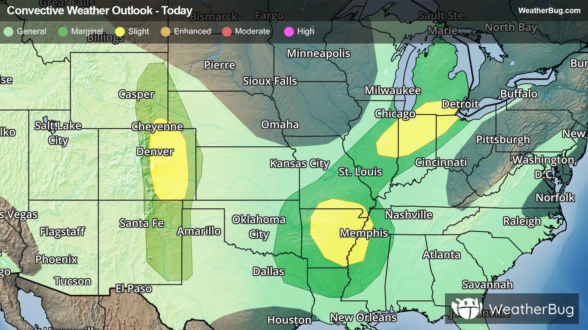
The Storm Prediction Center has posted one of three Slight Risks today, or a 2 out of 5 on the severe weather probability scale, mainly for eastern Colorado and including Denver and Colorado Springs, Colo. Here, isolated to widely scattered severe storms will be capable of damaging winds greater than 70 mph as well as tennis ball-sized hail or larger.
There is also a Marginal Risk, a 1 out of 5, from eastern New Mexico to southeastern Wyoming, where more isolated storms are likely. However, the large hail risk is mainly contained to the north, with strong, damaging winds more contained to the south.
Another Slight Risk is present over Arkansas, southern Missouri, southeastern Tennessee, and northwestern Mississippi. In this stretch of the Mid-South, isolated bouts of damaging winds and hail will also be possible early this afternoon, instigated by the survival of an overnight complex of thunderstorms and high humidity. Here, cities such as Little Rock, Ark., Memphis, Tenn., and Clarksdale, Miss., will be at risk.
The final Slight Risk today covers eastern Illinois through southern Michigan and northwestern Ohio, covering Champaign, Ill., Fort Wayne, Ind., Toledo, Ohio, and Detroit. Across this portion of the Lower Midwest, a strong upper-level disturbance will enable all severe threats, including isolated to widely scattered damaging winds, large hail, and even tornadic activity.
A Marginal Risk ties together and encompasses the Mid-South and Lower Midwest Slight Risks, with more occasional and brief severe storms capable of strong winds and hail.
Be sure to know the difference between a watch and a warning. A watch means that the conditions are in place to possibly produce severe weather, while a warning indicates that those conditions are currently occurring. Be sure to have multiple ways to receive warnings. Also, take caution if you are outdoors during a thunderstorm. Remember, “When Thunder Roars, Go Indoors!”