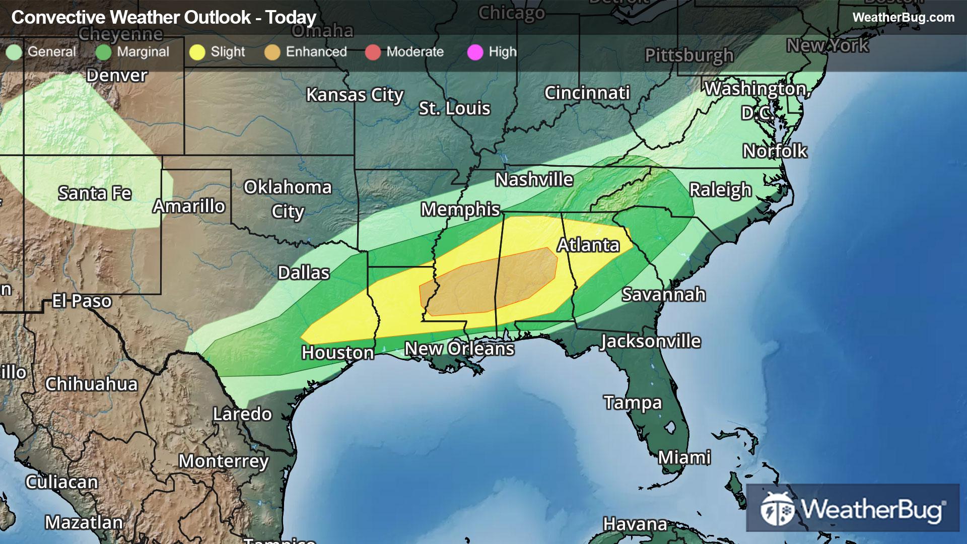
Severe Storms Shift Into the Deep South
Severe weather will shift into the Deep South today.
Read MoreSevere weather will shift into the Deep South today.
Read More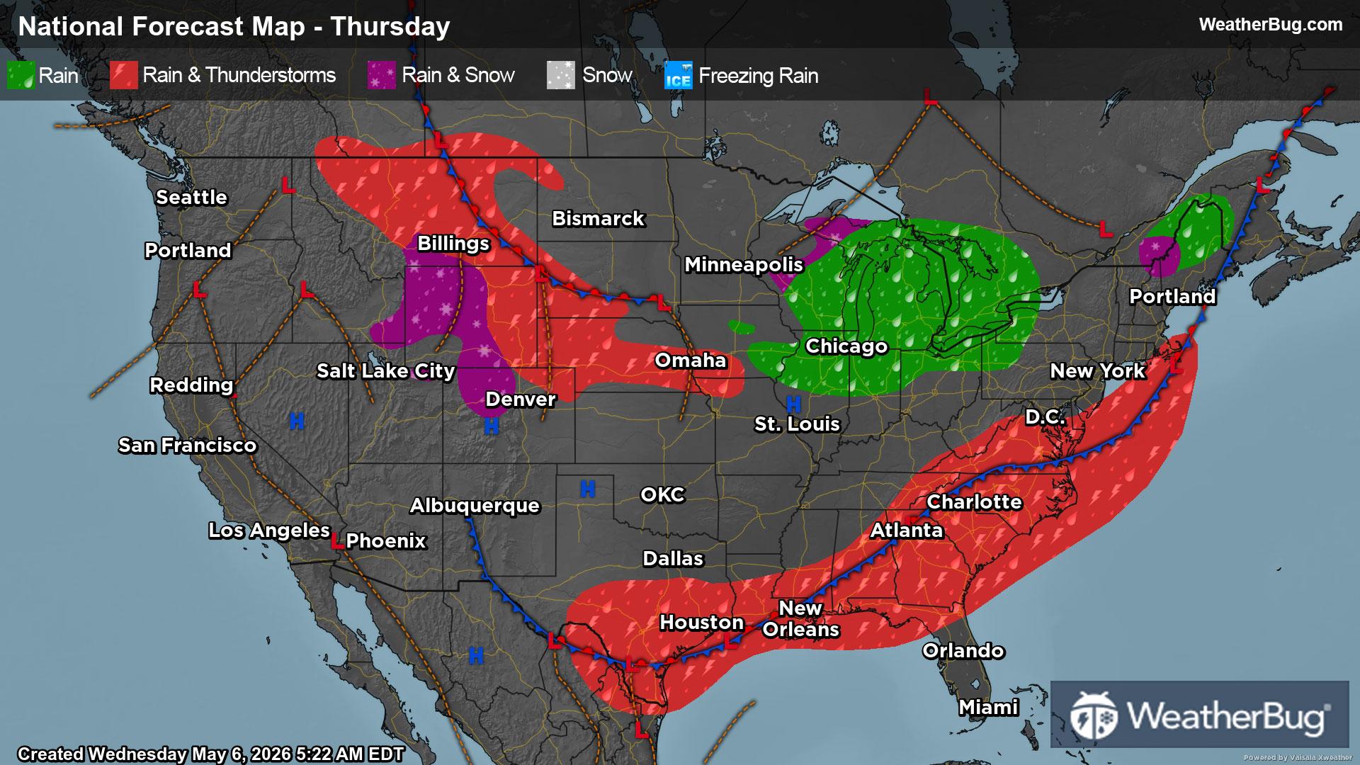
Much-needed rain will soak the Southeast while a cold front pushes through the Great Lakes and Northeast.
Read More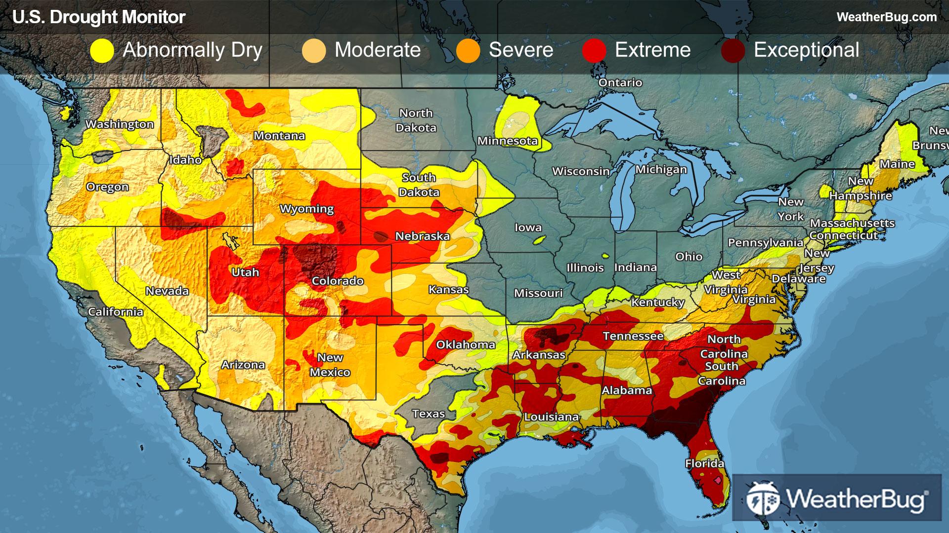
Deep drought continues western Plains to Rocky Mountains, and in the Southeast U.S.
Read More
Drought can have a wide range of effects on different industries that you may not necessarily expect.
Read More