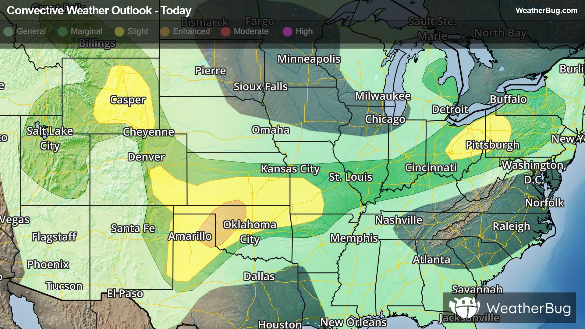
Central & Southern Plains Under Severe Threat
A low pressure system tracking across the central U.S. will produce severe thunderstorms over the southern Plains today.
Read More
55degrees Fahrenheit

Feels like:55°
Hi:75°Lo:55°
Mostly Cloudy
Lo

Mostly cloudy with a slight chance of showers and isolated thunderstorms in the evening then partly cloudy after midnight. Lows in the 40s. Chance of rain 20 percent.
Hi

Mostly sunny with a chance of showers in the morning then mostly cloudy with a chance of showers and thunderstorms in the afternoon. Highs 75 to 85. Southwest winds 10 to 15 mph in the afternoon. Gusts up to 25 mph. Chance of rain 50 percent.


Closest strike in the last 30 minutes:96.3 miles
No Lightning Nearby


