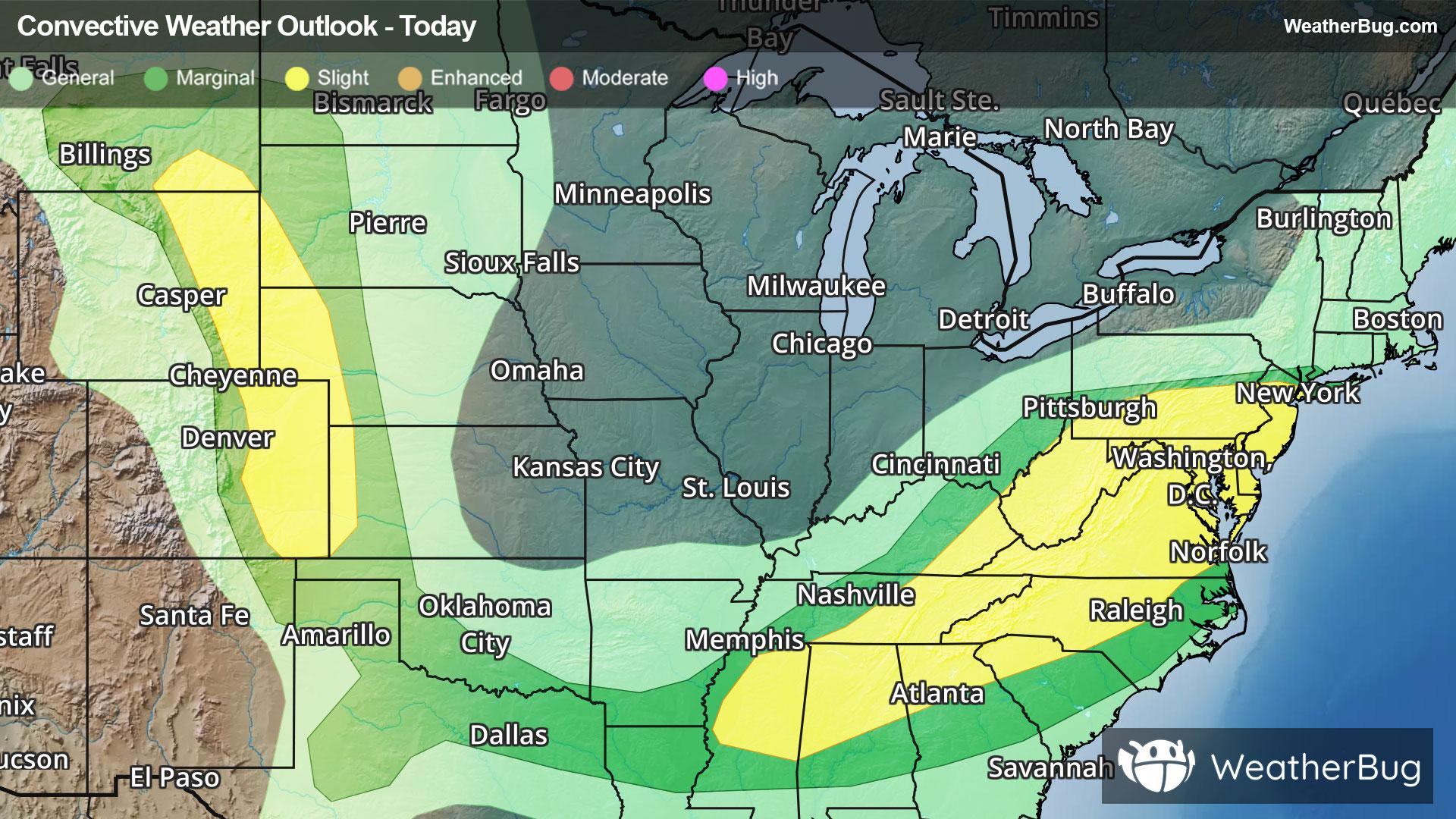
Brookfield, IL Weather

As of
Current Temperature
68

Feels like:68°

Today's high temperature
--
Today's low temperature
68°

Current Weather Condition40% Chance Rain Showers

Live Weather Radar

Brookfield, IL weather radar map

Current Weather Details

Windchill
68°
Daily Rain
--"
Dew point
68°
Monthly Rain
1.16"
Humidity
97%
Avg. Wind
SW 12 mph
Pressure
--"
Wind Gust
-- mph
Sunrise
5:16 AM
Moon
Waning Crescent
Sunset
8:25 PM
UV Index
9 (Very High)

Weather Forecast

  • Tonight

    Lo

    Mostly cloudy. A chance of showers and thunderstorms early in the evening then showers and thunderstorms likely late in the evening. A chance of showers and thunderstorms after midnight. Some thunderstorms may produce gusty winds until early morning. Breezy. Lows around 70. Southwest winds 10 to 15 mph with gusts up to 30 mph. Chance of precipitation 70 percent.

  • Tomorrow

    Hi

    Mostly cloudy. A chance of showers and thunderstorms late. Breezy with highs in the upper 80s. Southwest winds around 10 mph increasing to south 15 to 20 mph with gusts up to 30 mph in the afternoon. Chance of precipitation 50 percent.

Brookfield, IL 10-day weather forecast

AIR QUALITY

Air Quality Index
29|Fair
Top Triggers:
pm25
View Today's Air Quality details for Brookfield, IL

POLLEN COUNT & ALLERGY FORECAST

Pollen Count
--|Not Available
Predominant Pollen:
View the Pollen forecast details

LIGHTNING MAP

Closest strike in the last 30 minutes:79.0 miles

No Lightning Nearby

Real-time lightning alerts & live Map