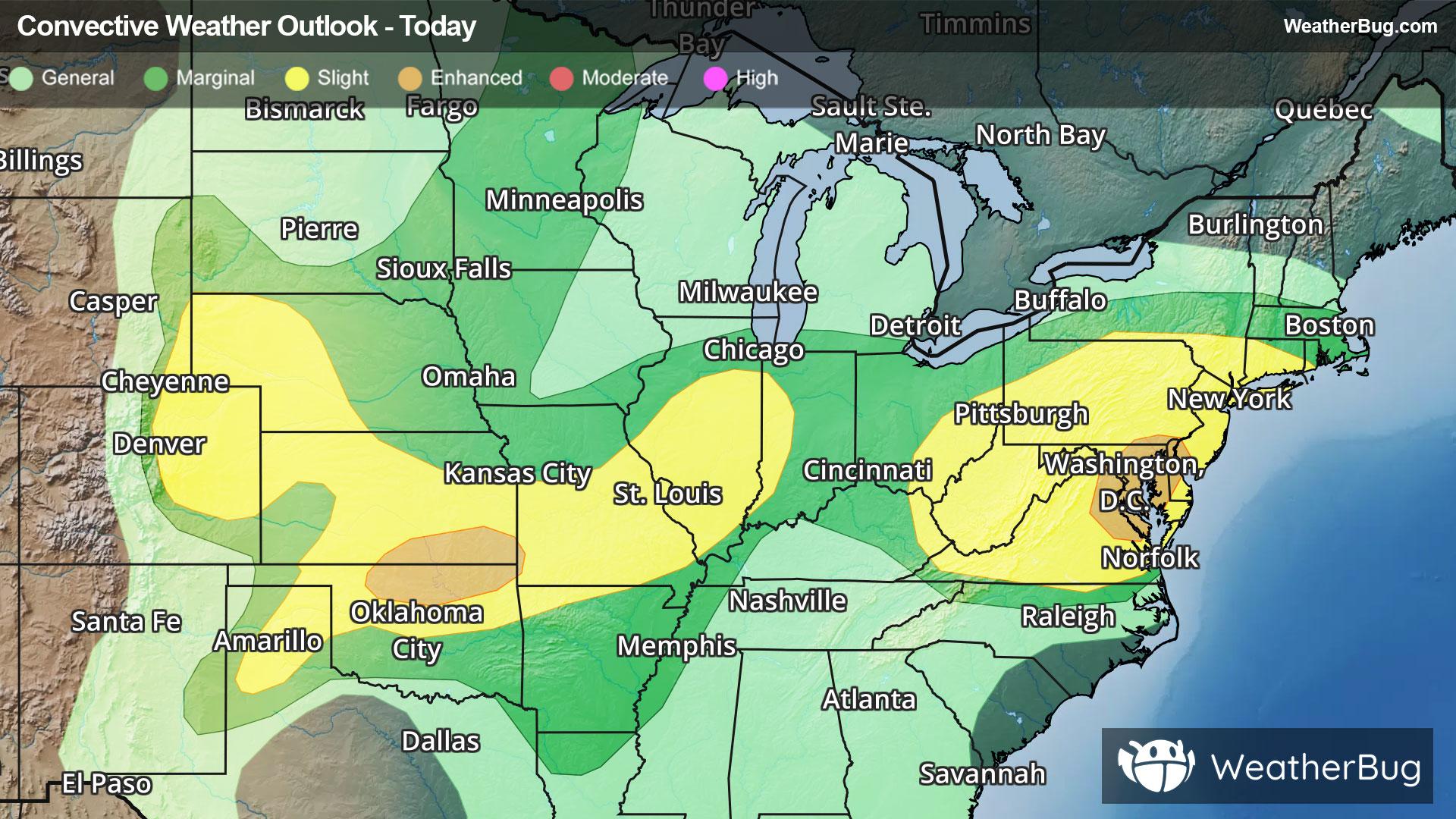
Storms Resurge in Mid-Atlantic, High Plains
Severe storms will return to both the High Plains and Mid-Atlantic this afternoon and evening when heated air masses ignite.
Read More
69degrees Fahrenheit

Feels like:69°
Hi:84°Lo:69°
70% Chance Rain Showers
Hi

Mostly cloudy with showers likely with a chance of thunderstorms this morning then partly sunny with a slight chance of showers and thunderstorms this afternoon. Highs in the mid 80s. West winds around 5 mph becoming northwest this afternoon. Chance of rain 70 percent.
Lo

Mostly cloudy in the evening then becoming partly cloudy. Humid with lows in the upper 60s. Northwest winds around 5 mph.


Closest strike in the last 30 minutes:111.7 miles
No Lightning Nearby
Severe storms will return to both the High Plains and Mid-Atlantic this afternoon and evening when heated air masses ignite.


