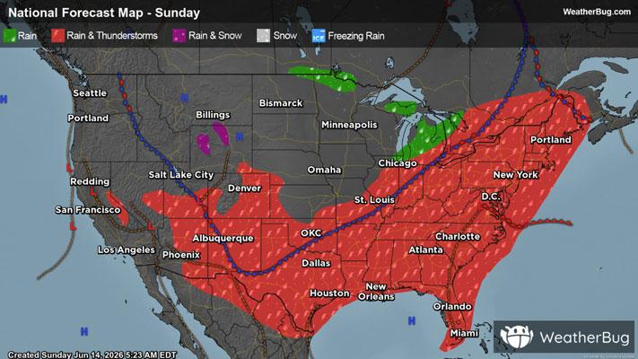
Brownville, NY Weather

As of

Weather Station:Watertown Intl Arpt Dexter

Open weather station selector modal

23degrees Fahrenheit

Feels like:5°F

Hi: 23Lo: 10

50% Chance of Heavy Snow

Live Weather Radar

Brownville, NY weather radar map

Current Weather Details

Windchill
Daily Rain
0"
Dew point
12°
Monthly Rain
2.78"
Humidity
63%
Avg. Wind
SW 31 mph
Pressure
29.76" →
Wind Gust
52 mph
Sunrise
7:33 AM
Moon
Waxing Crescent
Sunset
4:56 PM
UV Index
1 (Low)

Weather Forecast

  • Today

    Hi

    Partly cloudy with likely snow. Chance of precipitation 100%. High temperature around 23F. Dew point will be around 12F with an average humidity of 80%. Winds will be 15 mph from the SW.

  • Tonight

    Lo

    Lake effect snow and blowing snow. Snow may be heavy at times. Visibility one quarter mile or less at times. Additional accumulation 7 to 14 inches in the most persistent snows. Strong winds with lows 5 to 10 above. Southwest winds 35 to 50 mph becoming west and diminishing to 30 to 40 mph. Chance of snow near 100 percent.

Brownville, NY 10-day weather forecast

AIR QUALITY

23 | Fair

Top Triggers:pm25
Air quality data provided by Ambee
View Today's Air Quality details for Brownville, NY

POLLEN COUNT & ALLERGY FORECAST

0.1 Low

Predominant Pollen:None
View the Pollen forecast details

LIGHTNING MAP

Closest strike in the last 30 minutes:2260.4 miles

No Lightning Nearby

Real-time lightning alerts & live Map