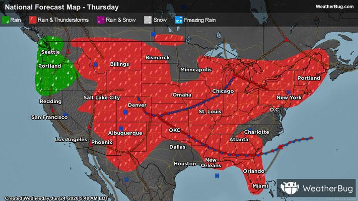
Intermountain West, High Plains Targeted by Severe Thunderstorms
The High Plains and a portion of the Intermountain West are locations to watch for severe thunderstorms today
Read More
63degrees Fahrenheit

Feels like:63°
Hi:77°Lo:63°
80% Chance Rain Showers
Lo

Mostly cloudy. Thunderstorms likely early in the evening. Showers in the evening. Thunderstorms likely late in the evening. Some thunderstorms may be severe with damaging winds and large hail early in the evening. Lows in the lower 60s. Southwest winds 5 to 10 mph. Chance of precipitation 80 percent.
Hi

Partly cloudy in the morning then becoming mostly cloudy. Highs in the upper 70s. West winds 5 to 10 mph.


Closest strike in the last 30 minutes:0.1 miles
Stay Alert!