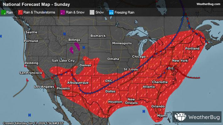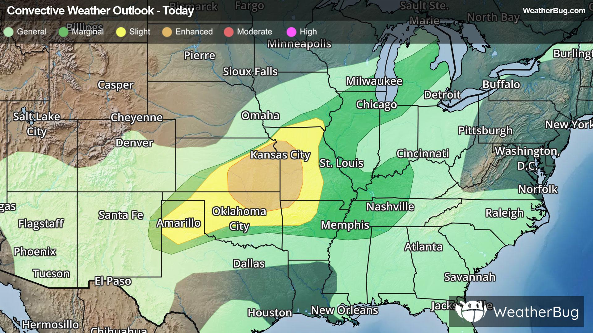
Severe Storms Taking Shape Across the Central U.S.
A new round of severe thunderstorms is taking aim across portions of the central Plains into the Midwest this evening.
Read More

40% Chance Rain Showers
Lo

Partly cloudy in the evening then becoming cloudy. A chance of showers and thunderstorms until early morning then showers and a chance of thunderstorms early in the morning. Lows in the upper 50s. Southwest winds 5 to 10 mph with gusts up to 25 mph becoming northwest early in the morning. Chance of rain 90 percent.
Hi

Mostly cloudy with showers likely and a slight chance of thunderstorms in the morning then partly cloudy with a slight chance of showers in the afternoon. Highs around 70. Northwest winds 5 to 15 mph. Gusts up to 30 mph in the afternoon. Chance of rain 70 percent.


Closest strike in the last 30 minutes:47.2 miles
No Lightning Nearby