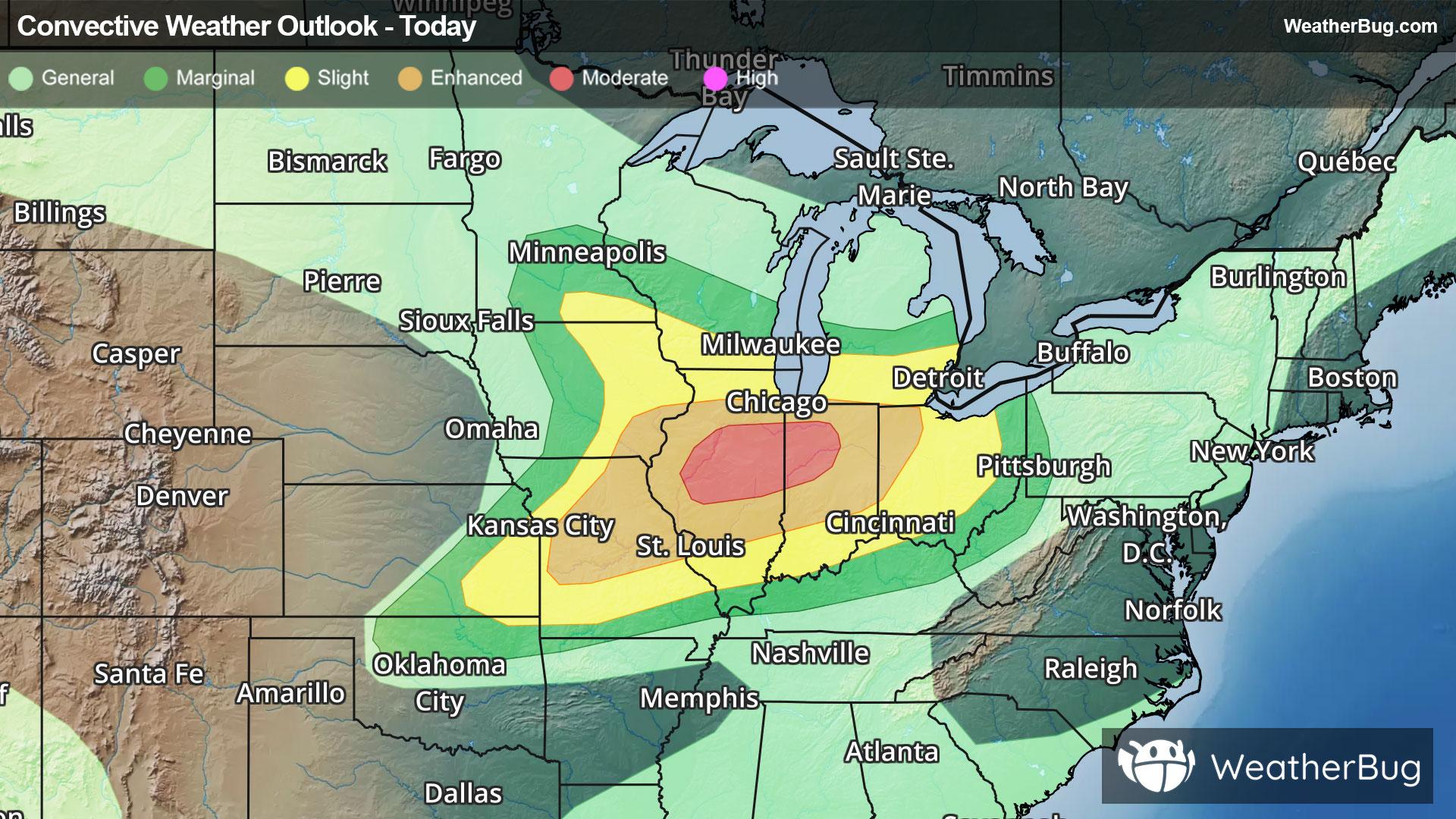
Severe Weather Outbreak Targets the Midwest
An outbreak of severe weather is expected across the Midwest today, including the risk for intense tornadoes.
Read More

Mostly Cloudy
Lo

Mostly cloudy. A chance of showers. Near steady temperature in the upper 40s. Light and variable winds becoming south around 5 mph. Chance of rain 40 percent.
Hi

Showers. A slight chance of thunderstorms in the afternoon. Highs around 60. Southeast winds 5 to 10 mph with gusts up to 25 mph. Chance of rain near 100 percent.


Closest strike in the last 30 minutes:288.5 miles
No Lightning Nearby
An outbreak of severe weather is expected across the Midwest today, including the risk for intense tornadoes.