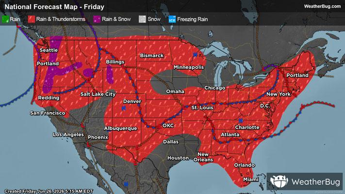
Dangerous Storms Expected Over The Ohio Valley & High Plains
An area of low pressure riding along a cold front over the Ohio and Mississippi Valleys will trigger thunderstorms, some which may be severe.
Read More
66degrees Fahrenheit

Feels like:66°
Hi:71°Lo:65°
40% Chance of Light Rain
Hi

Showers with a chance of thunderstorms. Cooler with highs around 70. East winds 5 to 10 mph. Chance of rain near 100 percent.
Lo

Mostly cloudy. Showers likely with a chance of thunderstorms in the evening then a chance of showers after midnight. Lows in the lower 60s. Northeast winds 5 to 10 mph. Chance of rain 70 percent.


Closest strike in the last 30 minutes:275.2 miles
No Lightning Nearby