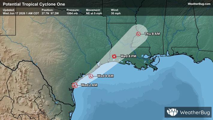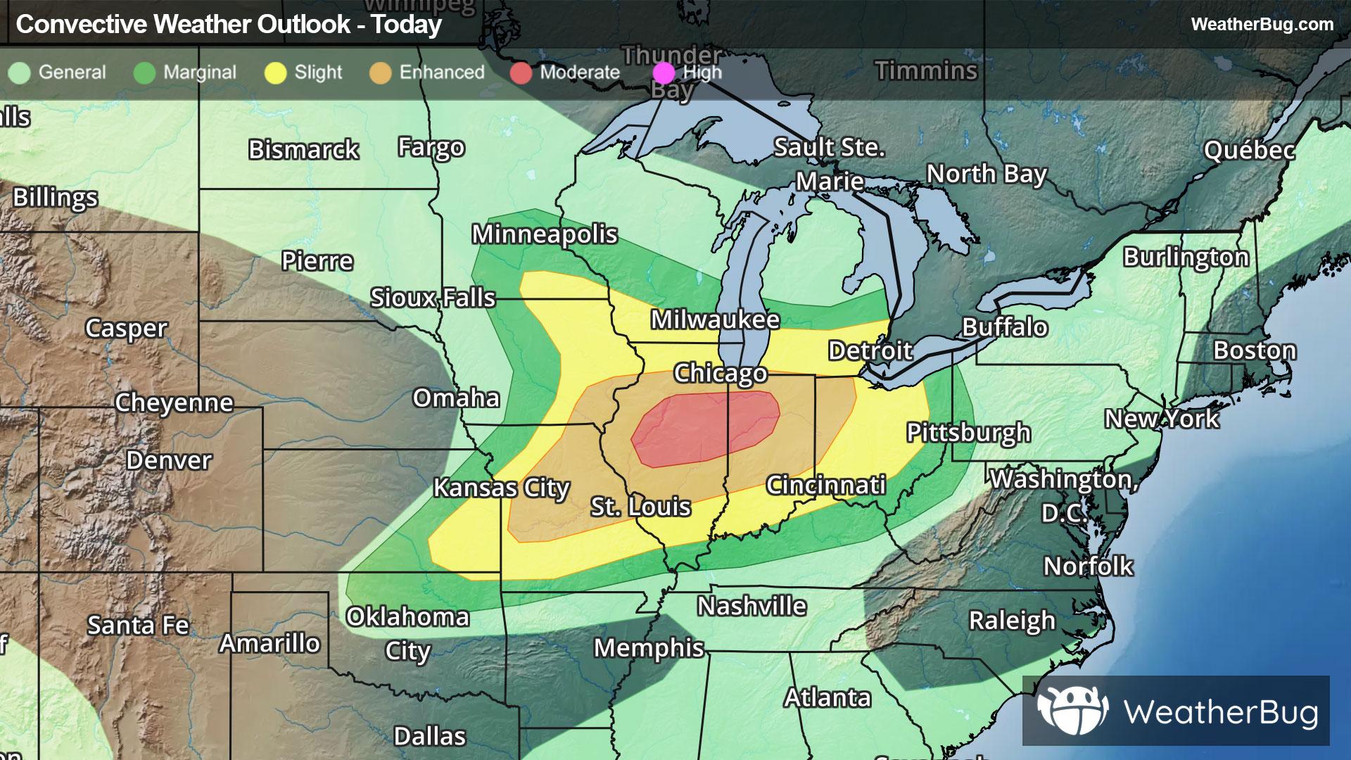
Severe Weather Outbreak Targets the Midwest
An outbreak of severe weather is expected across the Midwest today, including the risk for intense tornadoes.
Read More

Mostly Cloudy
Lo

Mostly cloudy with a chance of rain. Chance of precipitation 40%. Low temperature around 54F. Dew point will be around 53F with an average humidity of 79%. Winds will be 8 mph from the S.
Hi

Cloudy. A chance of showers late then showers likely in the morning. A chance of showers and thunderstorms in the afternoon. Highs in the upper 60s. North winds 5 to 15 mph with gusts up to 25 mph. Chance of rain 60 percent.


Closest strike in the last 30 minutes:162.6 miles
No Lightning Nearby
An outbreak of severe weather is expected across the Midwest today, including the risk for intense tornadoes.