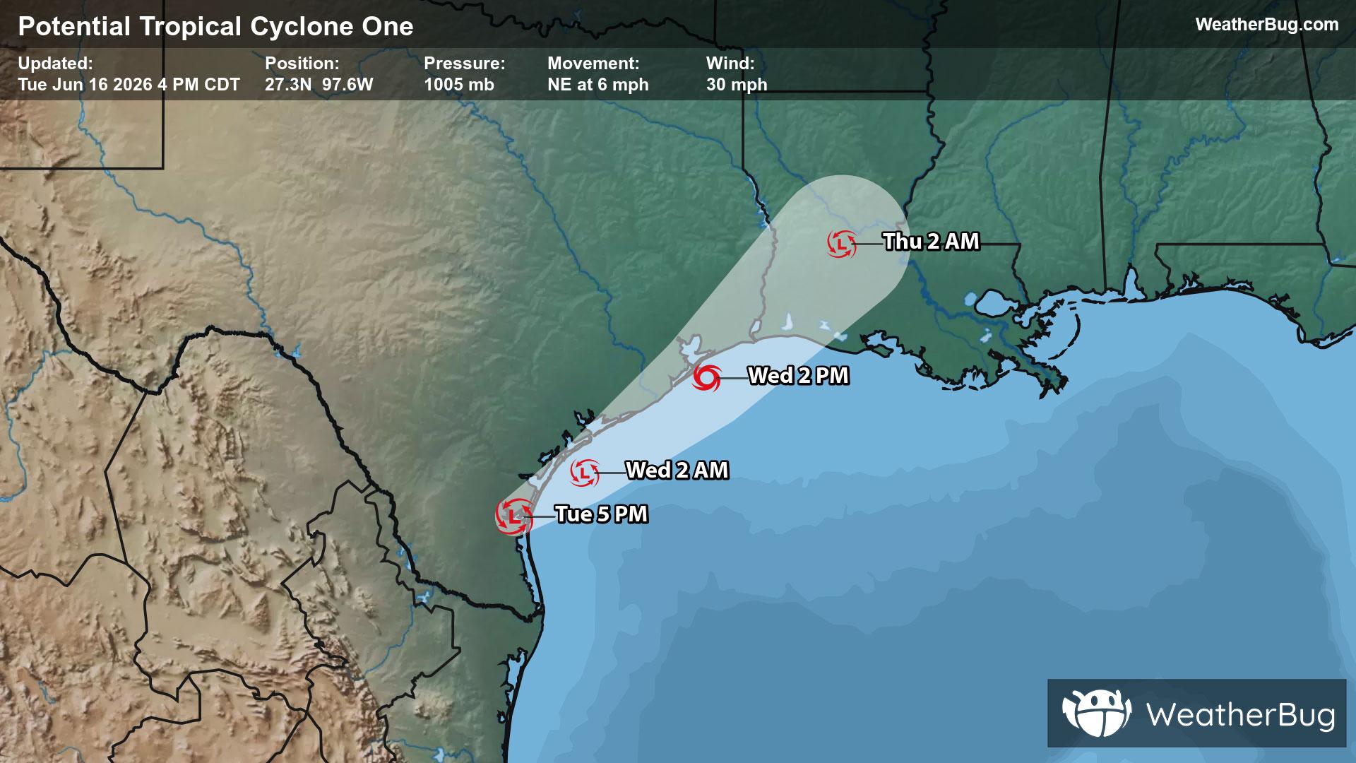
Chehalis, WA Weather

As of

Weather Station:CHEHALIS CENTRAL

Open weather station selector modal

34degrees Fahrenheit

Feels like:34°F

Hi: 46Lo: 32

40% Chance Rain Showers

Live Weather Radar

Chehalis, WA weather radar map

Current Weather Details

Windchill
34°
Daily Rain
0"
Dew point
34°
Monthly Rain
0.6"
Humidity
100%
Avg. Wind
N 0 mph
Pressure
30.11" →
Wind Gust
0 mph
Sunrise
7:36 AM
Moon
Waning Gibbous
Sunset
7:09 PM
UV Index
2 (Low)

Weather Forecast

  • Tonight

    Lo

    Mostly cloudy. A chance of rain showers and a slight chance of thunderstorms in the evening. A chance of snow. A chance of rain after midnight. Snow level near 1000 feet decreasing to 500 feet after midnight. Lows near 30. Southwest wind 10 to 15 mph in the evening becoming light.

  • Tomorrow

    Hi

    A chance of rain and snow in the morning then rain and snow in the afternoon. Snow level near 500 feet increasing to 1500 feet in the afternoon. No snow accumulation. Highs in the lower to mid 40s. South wind to 10 mph increasing to 10 to 15 mph in the afternoon. Gusts to 25 mph.

Chehalis, WA 10-day weather forecast

AIR QUALITY

22 | Fair

Top Triggers:pm25
Air quality data provided by Ambee
View Today's Air Quality details for Chehalis, WA

POLLEN COUNT & ALLERGY FORECAST

3.2 Low-Medium

Predominant Pollen:Alder, Cedar/Juniper and Elm
View the Pollen forecast details

LIGHTNING MAP

Closest strike in the last 30 minutes:1240.8 miles

No Lightning Nearby

Real-time lightning alerts & live Map