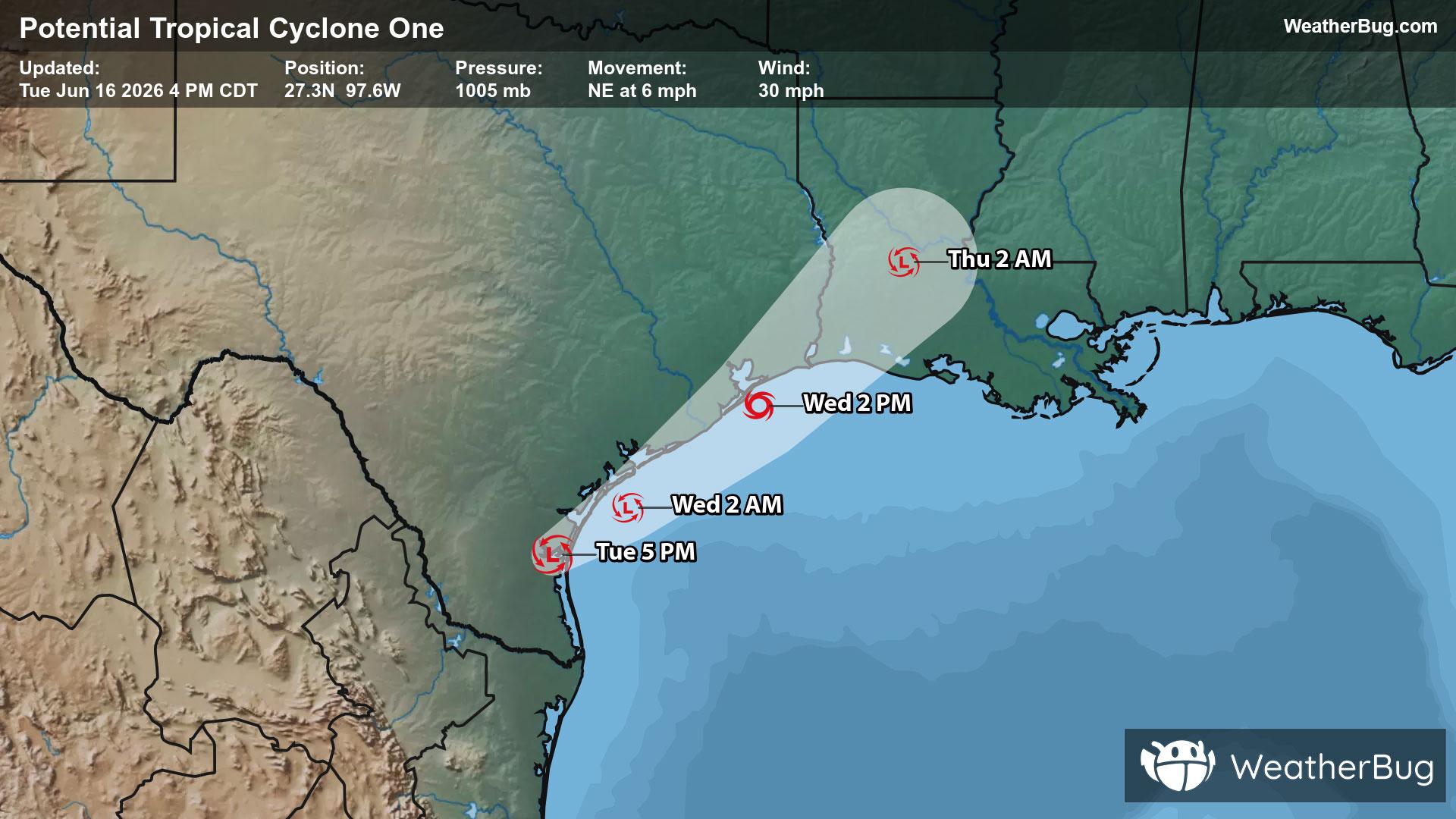
Potential Tropical Cyclone One May Become Atlantic's First Named Storm
A disorganized Potential Tropical Cyclone One may become the Atlantic season's first named storm on Wednesday.
Read More

Partly Cloudy
Lo

Mostly cloudy this evening then becoming partly cloudy. A slight chance of thunderstorms this evening. A chance of showers. Lows in the mid 50s. Southwest winds 10 to 15 mph. Chance of rain 50 percent.
Hi

Partly cloudy. A chance of showers and thunderstorms in the afternoon. Highs in the mid 70s. Southwest winds 5 to 10 mph. Chance of rain 50 percent.


Closest strike in the last 30 minutes:96.3 miles
No Lightning Nearby
A disorganized Potential Tropical Cyclone One may become the Atlantic season's first named storm on Wednesday.


