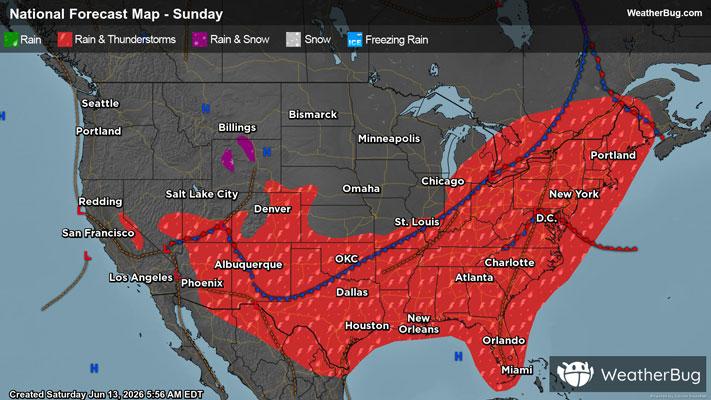
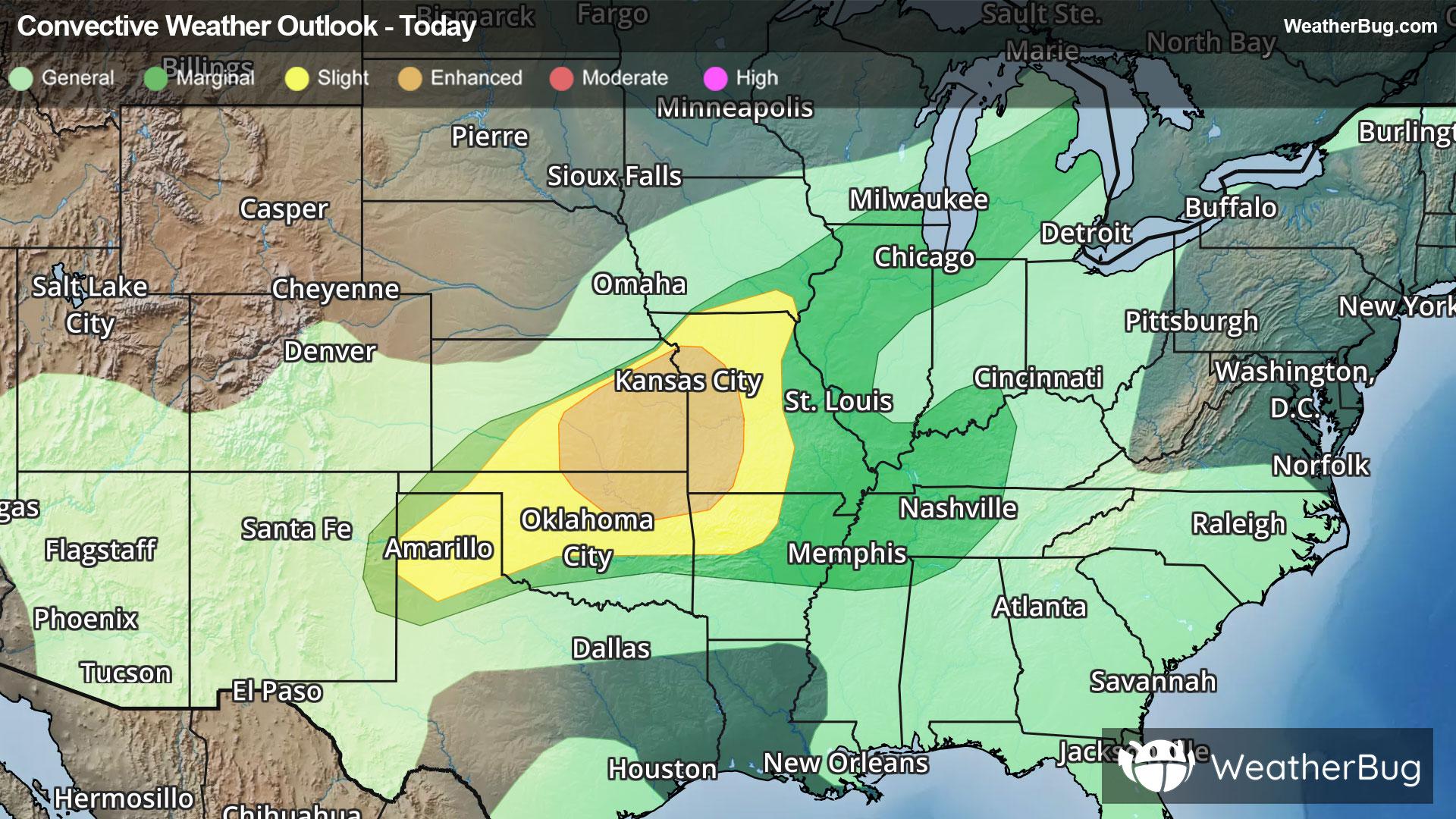
Chippewa Falls, WI Weather

As of

Weather Station:Chippewa Valley Arpt Eau Claire

Open weather station selector modal

12degrees Fahrenheit

Feels like:4°F

Hi: 12Lo: 12

Cloudy

Live Weather Radar

Chippewa Falls, WI weather radar map

Current Weather Details

Windchill
Daily Rain
0"
Dew point
Monthly Rain
0.95"
Humidity
73%
Avg. Wind
NW 5 mph
Pressure
29.79" →
Wind Gust
5 mph
Sunrise
7:39 AM
Moon
Waning Crescent
Sunset
4:52 PM
UV Index
1 (Low)

Weather Forecast

  • Tonight

    Lo

    Mostly cloudy with a chance of snow. Chance of precipitation 60%. Low temperature around 13F. Dew point will be around 11F with an average humidity of 79%. Winds will be 12 mph from the NW.

  • Tomorrow

    Hi

    Colder. Mostly cloudy. Chance of snow early in the morning then slight chance of snow late in the morning. Highs around 17. Northwest winds 5 to 15 mph. Chance of snow 40 percent.

Chippewa Falls, WI 10-day weather forecast

AIR QUALITY

16 | Excellent

Top Triggers:pm25
Air quality data provided by Ambee
View Today's Air Quality details for Chippewa Falls, WI

POLLEN COUNT & ALLERGY FORECAST

0.1 Low

Predominant Pollen:None
View the Pollen forecast details

LIGHTNING MAP

Closest strike in the last 30 minutes:1998.8 miles

No Lightning Nearby

Real-time lightning alerts & live Map