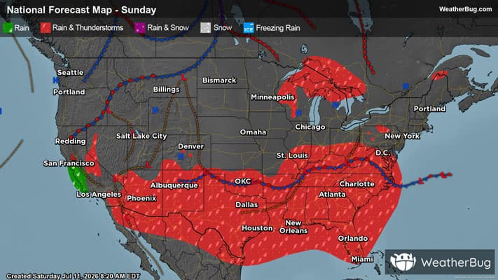
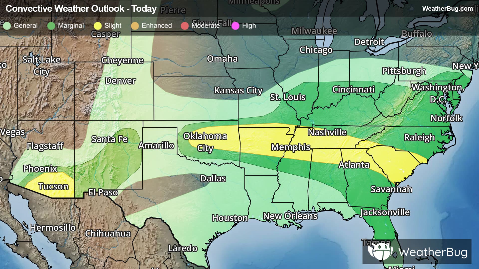
Climax, CO Weather

As of

Weather Station:Lake County Arpt - Leadville

Open weather station selector modal

35degrees Fahrenheit

Feels like:31°F

Hi: 48Lo: 31

40% Chance Freezing Rain

Live Weather Radar

Climax, CO weather radar map

Current Weather Details

Windchill
31°
Daily Rain
0"
Dew point
29°
Monthly Rain
0.85"
Humidity
78%
Avg. Wind
SW 5 mph
Pressure
30.06" →
Wind Gust
5 mph
Sunrise
6:49 AM
Moon
Waxing Gibbous
Sunset
7:28 PM
UV Index
7 (High)

Weather Forecast

  • Tonight

    Lo

    Snow showers likely and slight chance of thunderstorms. Patchy blowing snow. Snow accumulation of 2 to 3 inches. Lows 24 to 30. Southwest winds up to 30 mph with gusts to around 40 mph. Chance of precipitation 70 percent.

  • Tomorrow

    Hi

    Periods of snow showers and slight chance of thunderstorms. Patchy blowing snow. Snow accumulation of 2 to 5 inches. Highs 28 to 35. West winds 10 to 25 mph with gusts to around 45 mph. Chance of precipitation 80 percent.

Climax, CO 10-day weather forecast

AIR QUALITY

26 | Fair

Top Triggers:pm25
Air quality data provided by Ambee
View Today's Air Quality details for Climax, CO

POLLEN COUNT & ALLERGY FORECAST

10.2 High

Predominant Pollen:Maple, Cedar/Juniper and Poplar/Aspen/Cottonwood.
View the Pollen forecast details

LIGHTNING MAP

Closest strike in the last 30 minutes:528.1 miles

No Lightning Nearby

Real-time lightning alerts & live Map