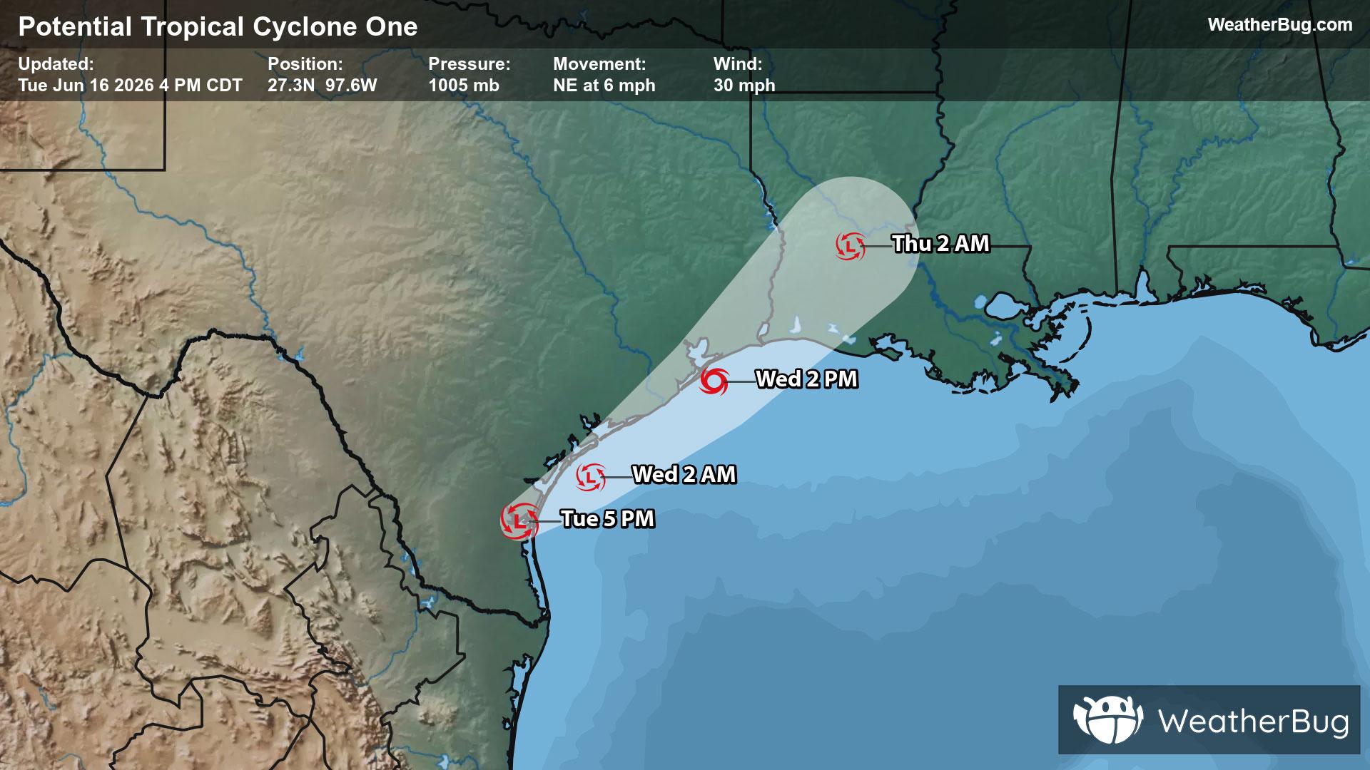
Potential Tropical Cyclone One May Become Atlantic's First Named Storm
A disorganized Potential Tropical Cyclone One may become the Atlantic season's first named storm on Wednesday.
Read More

Partly Cloudy
Lo

Mostly cloudy this evening then clearing. Patchy fog after midnight. Lows in the mid 50s. West winds 5 to 10 mph.
Hi

Patchy fog in the morning. Sunny. Highs in the upper 70s. West winds 5 to 10 mph.


Closest strike in the last 30 minutes:352.6 miles
No Lightning Nearby
A disorganized Potential Tropical Cyclone One may become the Atlantic season's first named storm on Wednesday.


