Halloween Weather Forecast 2026: Who Could See Rain?
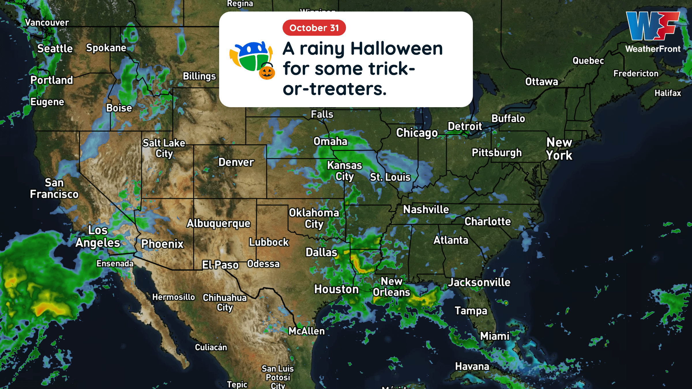
Halloween will be warmer than average across much of the central and eastern U.S., but rain could complicate trick-or-treating in several regions.
Read More
42degrees Fahrenheit

Feels like:41°
Hi:42°Lo:32°
80% Chance Rain Showers
Hi

Partly cloudy with probable rain. Chance of precipitation 75%. High temperature around 42F. Dew point will be around 40F with an average humidity of 92%. Winds will be 8 mph from the ESE.
Lo

Rain and mountain snow showers in the evening, then rain and mountain snow showers likely overnight. Patchy fog overnight. Mountain snow accumulation up to 1 inch. Snow level 4000 feet. Lows in the lower to mid 30s. Chance of precipitation near 100 percent.


Rain starting in 16 minutes, ending in 27 minutes.
Closest strike in the last 30 minutes:10.9 miles
Storms Approaching


Halloween will be warmer than average across much of the central and eastern U.S., but rain could complicate trick-or-treating in several regions.