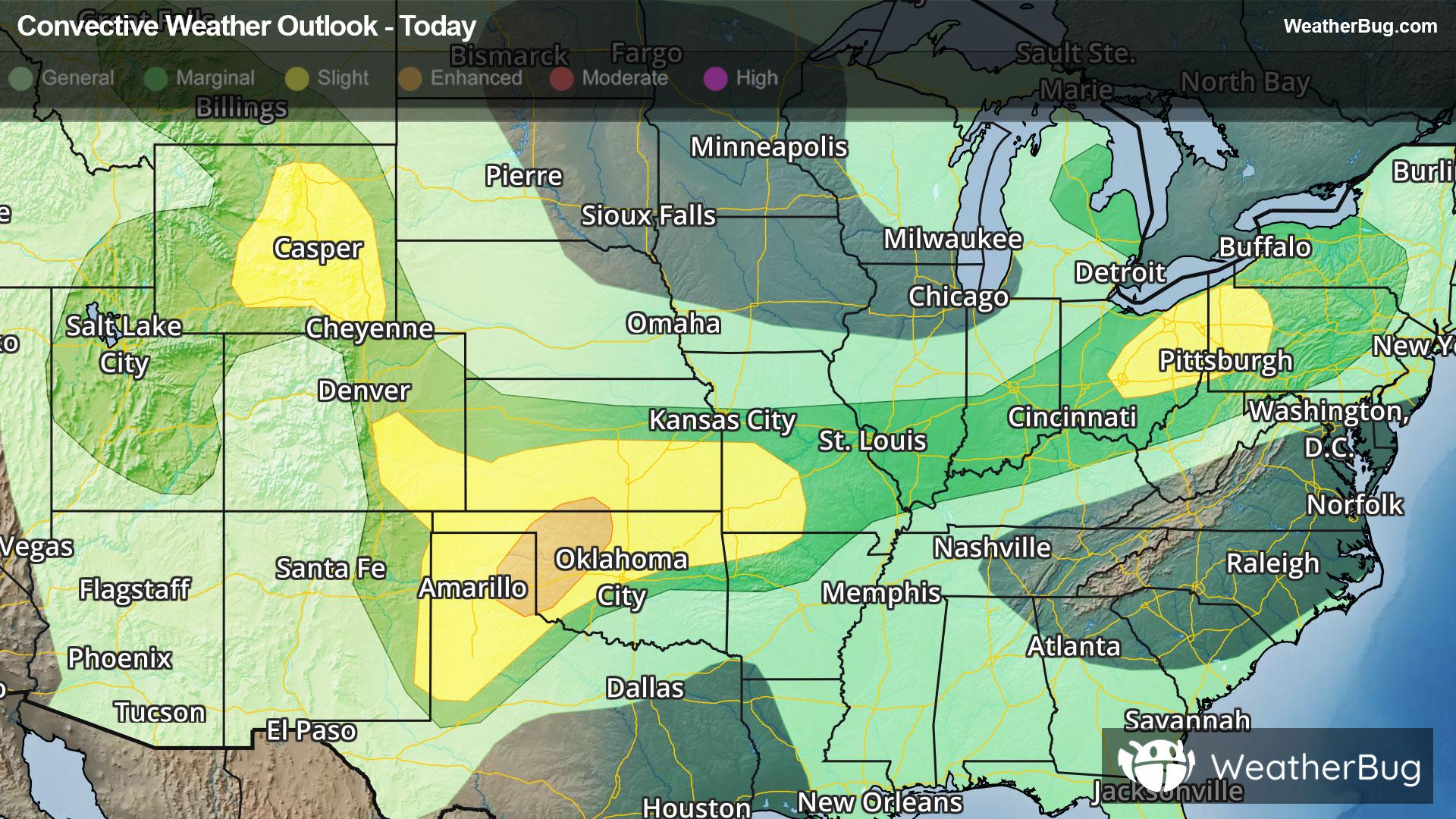
Conway, MI Weather

As of

Weather Station:Harbor Springs Airport

Open weather station selector modal

26degrees Fahrenheit

Feels like:16°F

Hi: 30Lo: 26

Mostly Cloudy

Live Weather Radar

Conway, MI weather radar map

Current Weather Details

Windchill
16°
Daily Rain
0"
Dew point
18°
Monthly Rain
2.08"
Humidity
74%
Avg. Wind
ENE 10 mph
Pressure
30.21" →
Wind Gust
10 mph
Sunrise
7:54 AM
Moon
Waning Crescent
Sunset
7:43 PM
UV Index
3 (Moderate)

Weather Forecast

  • Tonight

    Lo

    Snow after midnight. Snow may be heavy at times after midnight. Total nighttime snow accumulation of 2 to 4 inches. Lows around 20. East winds up to 15 mph. Gusts up to 30 mph after midnight.

  • Tomorrow

    Hi

    Snow and sleet early then snow sleet and freezing rain in the afternoon. Areas of blowing snow early. Blowing snow in the afternoon. Breezy. Precipitation may be heavy at times. Visibility one quarter mile or less at times. Total daytime snow accumulation of 6 to 17 inches. Ice accumulation of up to one quarter of an inch. Highs in the lower 30s. East winds 15 to 25 mph with gusts to around 40 mph.

Conway, MI 10-day weather forecast

AIR QUALITY

19 | Excellent

Top Triggers:pm25
Air quality data provided by Ambee
View Today's Air Quality details for Conway, MI

POLLEN COUNT & ALLERGY FORECAST

0.5 Low

Predominant Pollen:Cedar/Juniper, Maple and Poplar/Cottonwood
View the Pollen forecast details

LIGHTNING MAP

Closest strike in the last 30 minutes:709.3 miles

No Lightning Nearby

Real-time lightning alerts & live Map