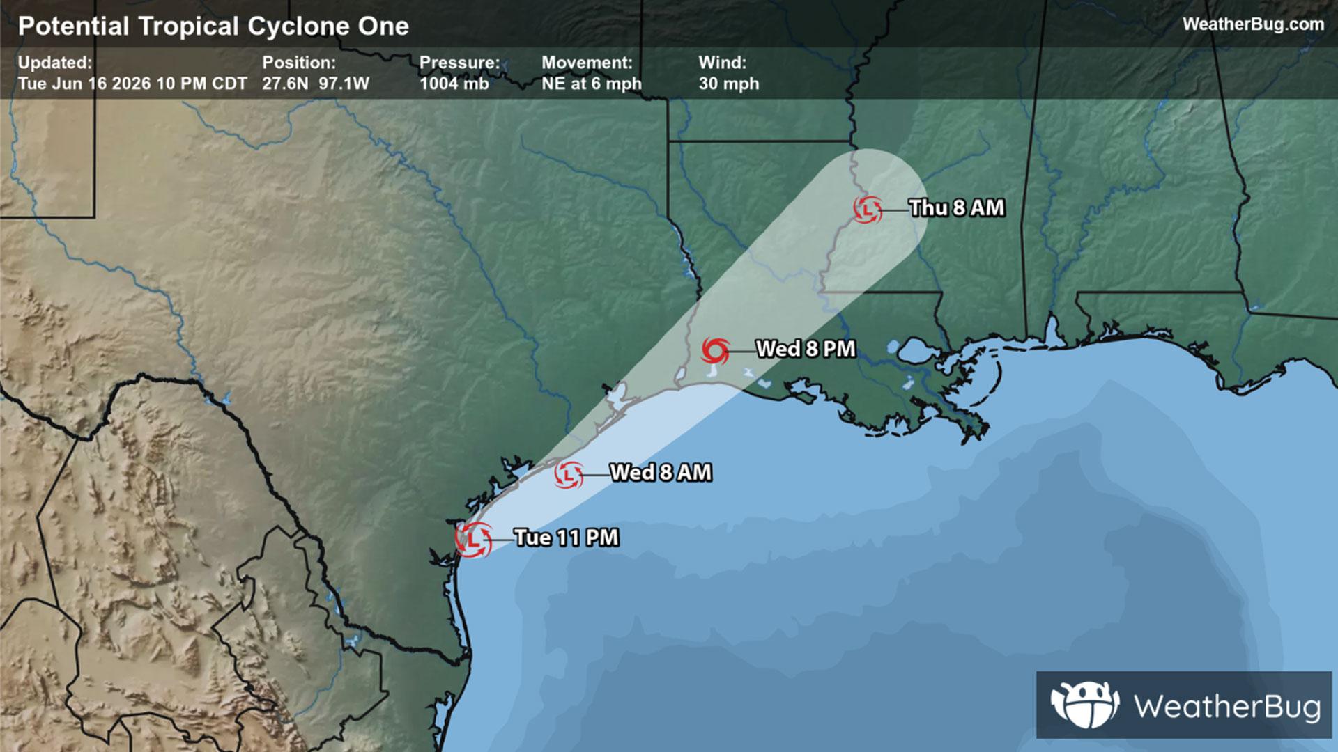
Potential Tropical Cyclone One May Become Atlantic's First Named Storm
A disorganized Potential Tropical Cyclone One may become the Atlantic season's first named storm on Wednesday.
Read More

Mostly Clear
Lo

Partly cloudy and breezy. Lows in the upper 60s. South winds 10 to 15 mph with gusts up to 25 mph increasing to 15 to 25 mph with gusts up to 40 mph after midnight.
Hi

Sunny breezy warmer with highs in the lower 90s. Southwest winds 20 to 25 mph becoming northwest in the afternoon. Gusts up to 45 mph.


Closest strike in the last 30 minutes:154.2 miles
No Lightning Nearby
A disorganized Potential Tropical Cyclone One may become the Atlantic season's first named storm on Wednesday.


