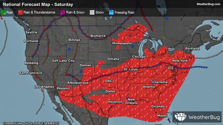
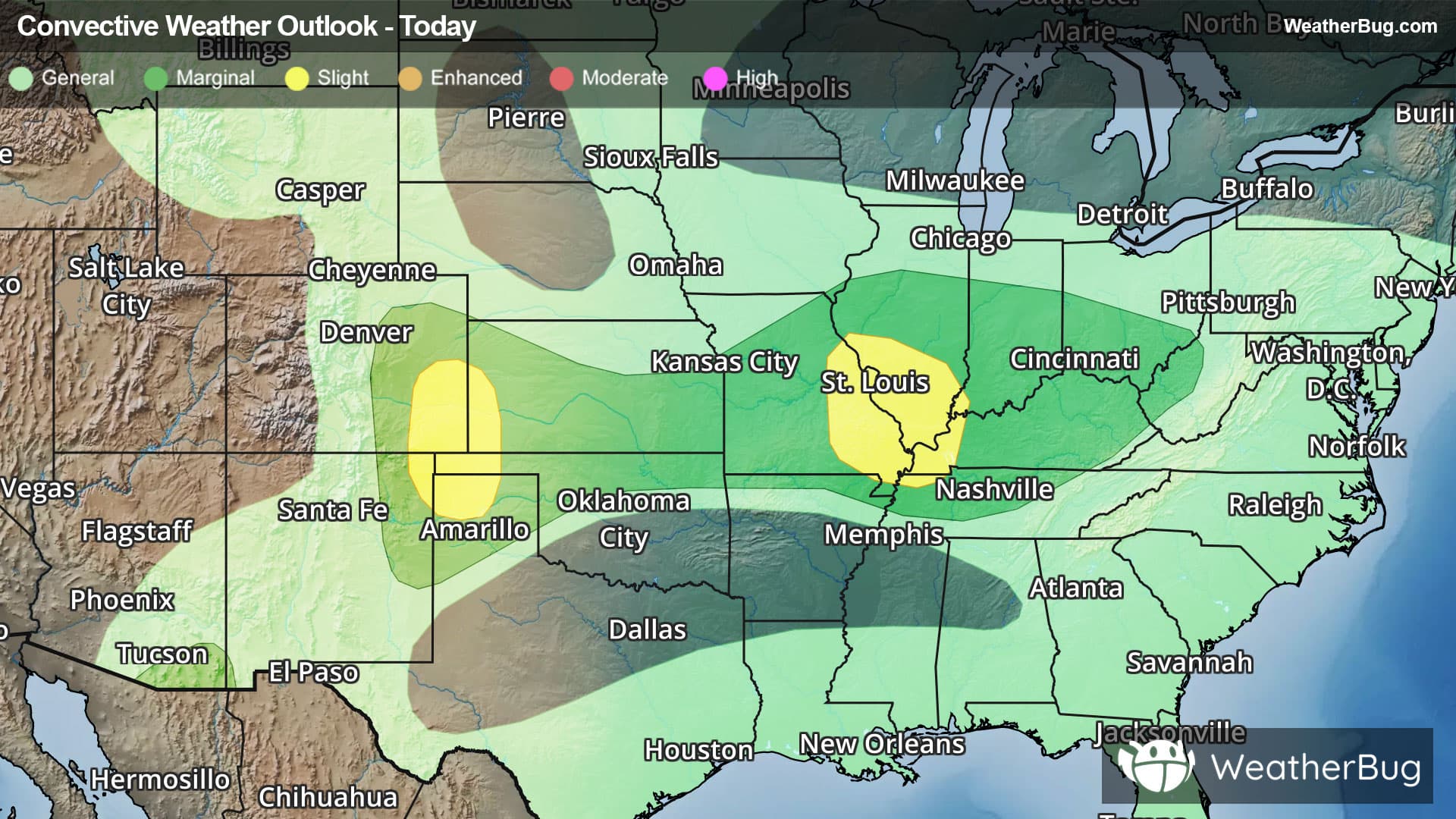
Cottonwood Falls, KS Weather

As of
Current Temperature
77

Feels like:77°

Today's high temperature
84°
Today's low temperature
67°

Current Weather ConditionMostly Sunny

Live Weather Radar

Cottonwood Falls, KS weather radar map

Current Weather Details

Windchill
79°
Daily Rain
--"
Dew point
63°
Monthly Rain
0.6"
Humidity
60%
Avg. Wind
S 11 mph
Pressure
--"
Wind Gust
-- mph
Sunrise
6:15 AM
Moon
Waning Crescent
Sunset
8:30 PM
UV Index
8 (Very High)

Weather Forecast

  • Today

    Hi

    Mostly sunny. A slight chance of showers and thunderstorms late this morning. Highs in the lower 90s. South winds 15 to 20 mph. Chance of rain 20 percent.

  • Tonight

    Lo

    Partly cloudy in the evening then becoming mostly cloudy. A slight chance of thunderstorms in the evening. A slight chance of showers. Lows in the upper 60s. South winds 10 to 15 mph with gusts up to 25 mph. Chance of rain 20 percent.

Cottonwood Falls, KS 10-day weather forecast

AIR QUALITY

Air Quality Index
34|Fair
Top Triggers:
pm25
View Today's Air Quality details for Cottonwood Falls, KS

POLLEN COUNT & ALLERGY FORECAST

Pollen Count
10.2|High
Predominant Pollen:
Walnut, Mulberry, Grass
View the Pollen forecast details

LIGHTNING MAP

Closest strike in the last 30 minutes:268.6 miles

No Lightning Nearby

Real-time lightning alerts & live Map