Storms Bring Flood & Severe Risk from the High Plains to the Carolinas
Two low pressure systems will bring severe weather conditions to the High Plains and Carolinas today.
Read More
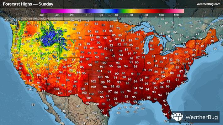
82degrees Fahrenheit

Feels like:86°
Hi:83°Lo:68°
Windy
Hi

Mostly sunny. High temperature around 83F. Dew point will be around 66F with an average humidity of 74%. Winds will be 17 mph from the SE.
Lo

Breezy. Mostly clear in the evening then becoming partly cloudy. Lows in the mid 60s. Southeast winds 15 to 25 mph becoming south 10 to 15 mph after midnight.


Closest strike in the last 30 minutes:168.3 miles
No Lightning Nearby
Two low pressure systems will bring severe weather conditions to the High Plains and Carolinas today.