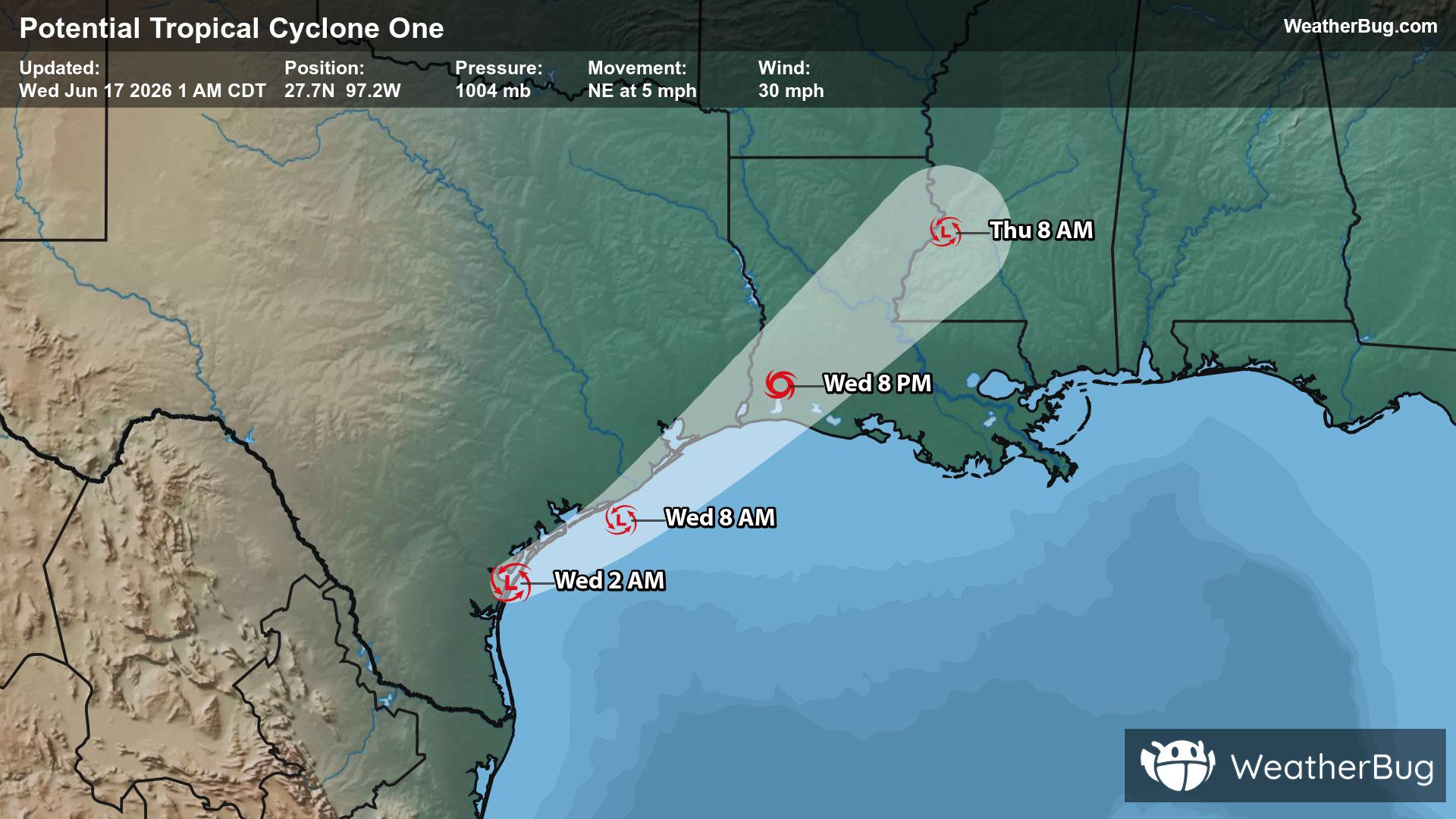
Potential Tropical Cyclone One May Become Atlantic's First Named Storm
A disorganized Potential Tropical Cyclone One may become the Atlantic season's first named storm today.
Read More

70% Chance of Light Rain
Lo

Chance of rain showers late in the evening then rain showers and slight chance of thunderstorms after midnight. Lows in the mid 50s. Southeast winds up to 5 mph increasing to 5 to 15 mph after midnight. Chance of precipitation 90 percent.
Hi

Rain showers likely and chance of thunderstorms. Highs in the upper 60s. Southeast winds 10 to 15 mph shifting to the west in the afternoon. Chance of precipitation 70 percent.


Closest strike in the last 30 minutes:207.2 miles
No Lightning Nearby
A disorganized Potential Tropical Cyclone One may become the Atlantic season's first named storm today.


