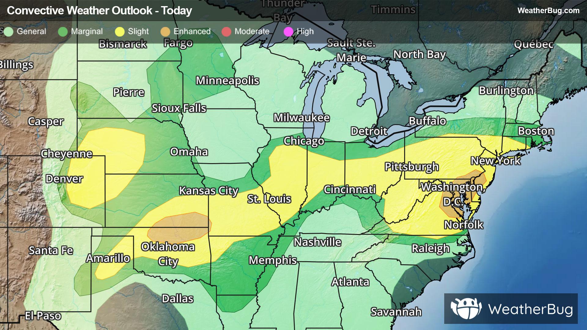
Storms Resurge in Mid-Atlantic, High Plains
Severe storms will return to both the High Plains and Mid-Atlantic this afternoon and evening when heated air masses ignite.
Read More
79degrees Fahrenheit

Feels like:79°
Hi:81°Lo:68°
30% Chance Rain Showers
Hi

Mostly cloudy with a chance of showers and thunderstorms through early afternoon then partly sunny with showers likely with a chance of thunderstorms late. Highs in the lower 80s. West winds around 10 mph. Chance of rain 70 percent.
Lo

Mostly cloudy. A chance of showers and thunderstorms in the evening then a chance of showers overnight. Muggy with lows ranging from the mid 60s in interior valleys to around 70 along the lake erie shore. Light south winds. Chance of rain 50 percent.


Closest strike in the last 30 minutes:187.6 miles
No Lightning Nearby
Severe storms will return to both the High Plains and Mid-Atlantic this afternoon and evening when heated air masses ignite.


