

Today's Weather Outlook
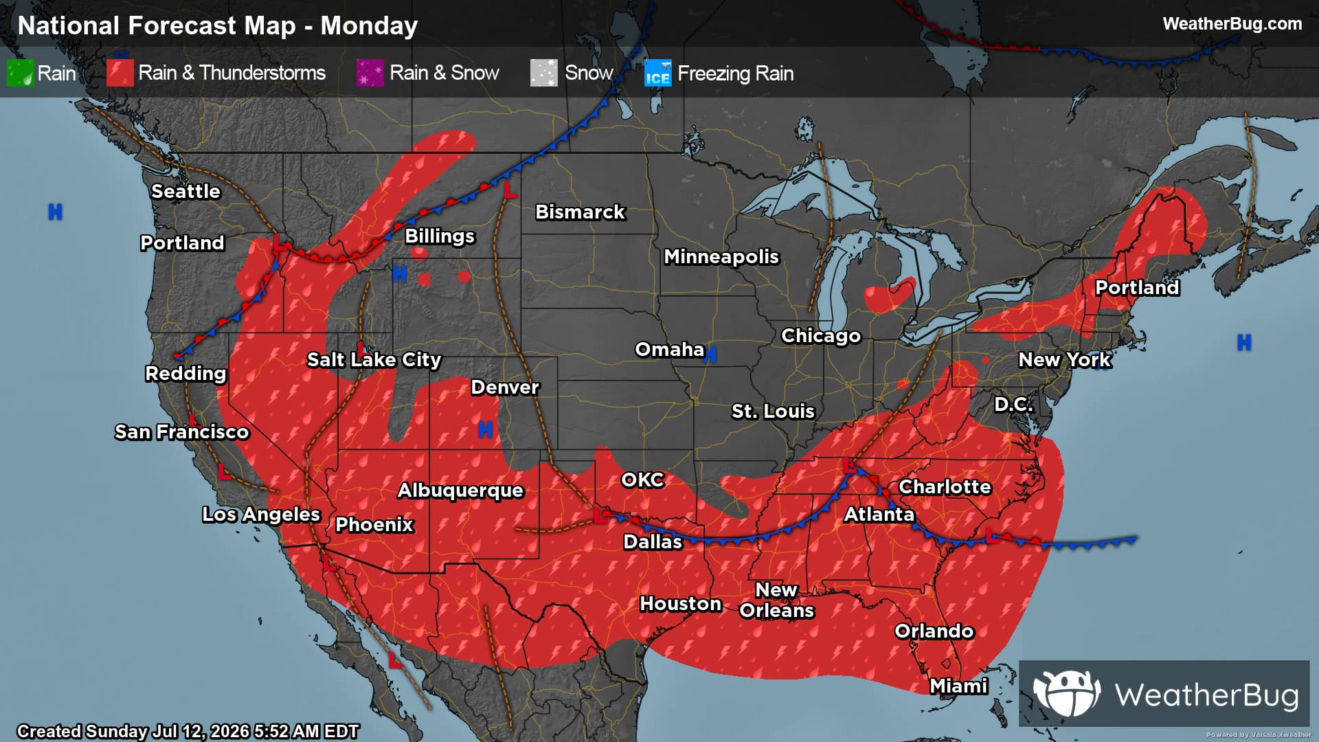
Rain and thunderstorms are set to soak much of the Southern Tier today.
Read More
70degrees Fahrenheit

Feels like:70°
Hi:73°Lo:70°
Clear
Lo

Clear. Low temperature around 71F. Dew point will be around 69F with an average humidity of 83%. Winds will be 6 mph from the NE.
Hi

Mostly sunny. Hot with highs around 90. Northeast winds 5 to 10 mph.


Closest strike in the last 30 minutes:323.2 miles
No Lightning Nearby


