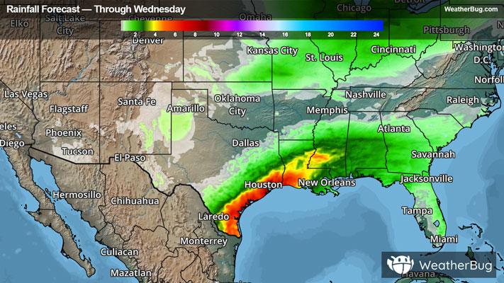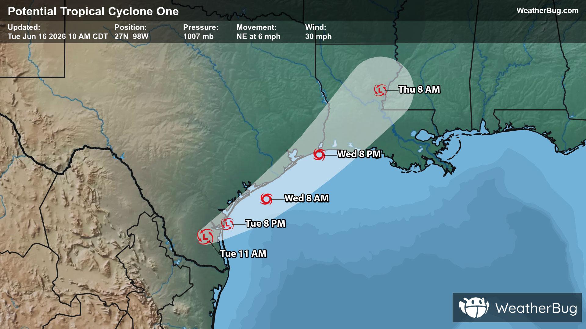
Tropics Coming Alive in the Gulf
A broad area of low pressure has become Potential Tropical Cyclone One over southern Texas.
Read More

70% Chance of Light Rain
Hi

Showers and thunderstorms likely. Patchy fog. Some thunderstorms may produce heavy rainfall. Cooler. Near steady temperature in the upper 70s. West winds around 5 mph. Chance of rain 70 percent.
Lo

Patchy fog in the evening. Mostly cloudy with a chance of thunderstorms. A chance of showers in the evening then showers likely after midnight. Some thunderstorms may produce heavy rainfall. Humid. Near steady temperature in the upper 70s. South winds around 5 mph. Chance of rain 70 percent.

Closest strike in the last 30 minutes:4.8 miles
Stay Alert!
A broad area of low pressure has become Potential Tropical Cyclone One over southern Texas.