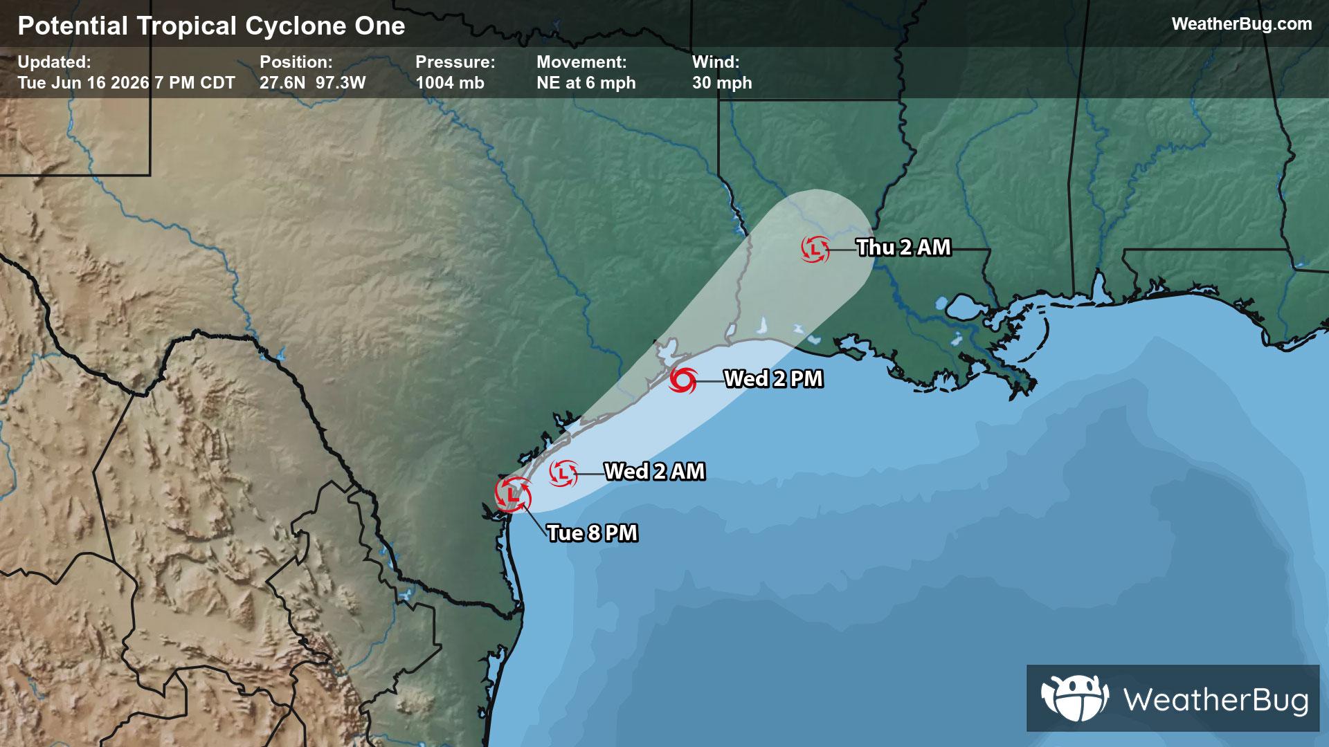
Potential Tropical Cyclone One May Become Atlantic's First Named Storm
A disorganized Potential Tropical Cyclone One may become the Atlantic season's first named storm on Wednesday.
Read More

40% Chance Rain Showers
Lo

Partly cloudy with a 95% chance for rain and thunderstorms. Low temperature around 55F. Dew point will be around 53F with an average humidity of 90%. Winds will be 9 mph from the SW.
Hi

Showers and a chance of thunderstorms. Southwest winds 10 to 15 mph with gusts up to 25 mph. Chance of rain 90 percent.


Closest strike in the last 30 minutes:23.2 miles
Monitor Storms
A disorganized Potential Tropical Cyclone One may become the Atlantic season's first named storm on Wednesday.


