Halloween Weather Forecast 2026: Who Could See Rain?
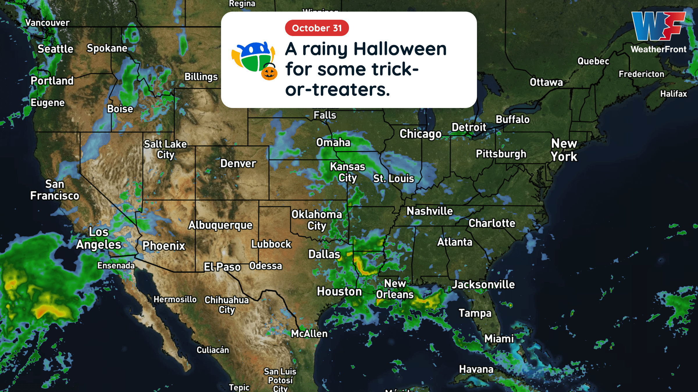
Halloween will be warmer than average across much of the central and eastern U.S., but rain could complicate trick-or-treating in several regions.
Read More
60degrees Fahrenheit

Feels like:60°
Hi:60°Lo:57°
Clear
Lo

Clear. Low temperature around 57F. Dew point will be around 49F with an average humidity of 79%. Winds will be 13 mph from the SSE.
Hi

Sunny. High temperature around 92F. Dew point will be around 59F with an average humidity of 41%. Winds will be 15 mph from the SW.


Closest strike in the last 30 minutes:1358.9 miles
No Lightning Nearby


Halloween will be warmer than average across much of the central and eastern U.S., but rain could complicate trick-or-treating in several regions.