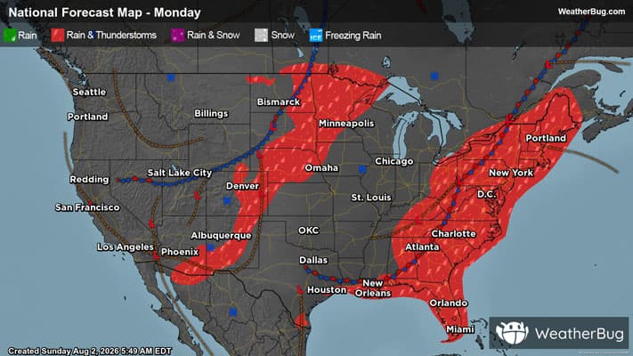
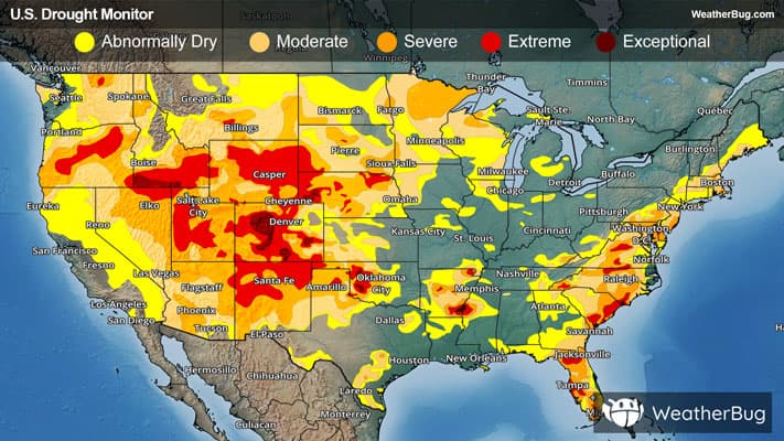
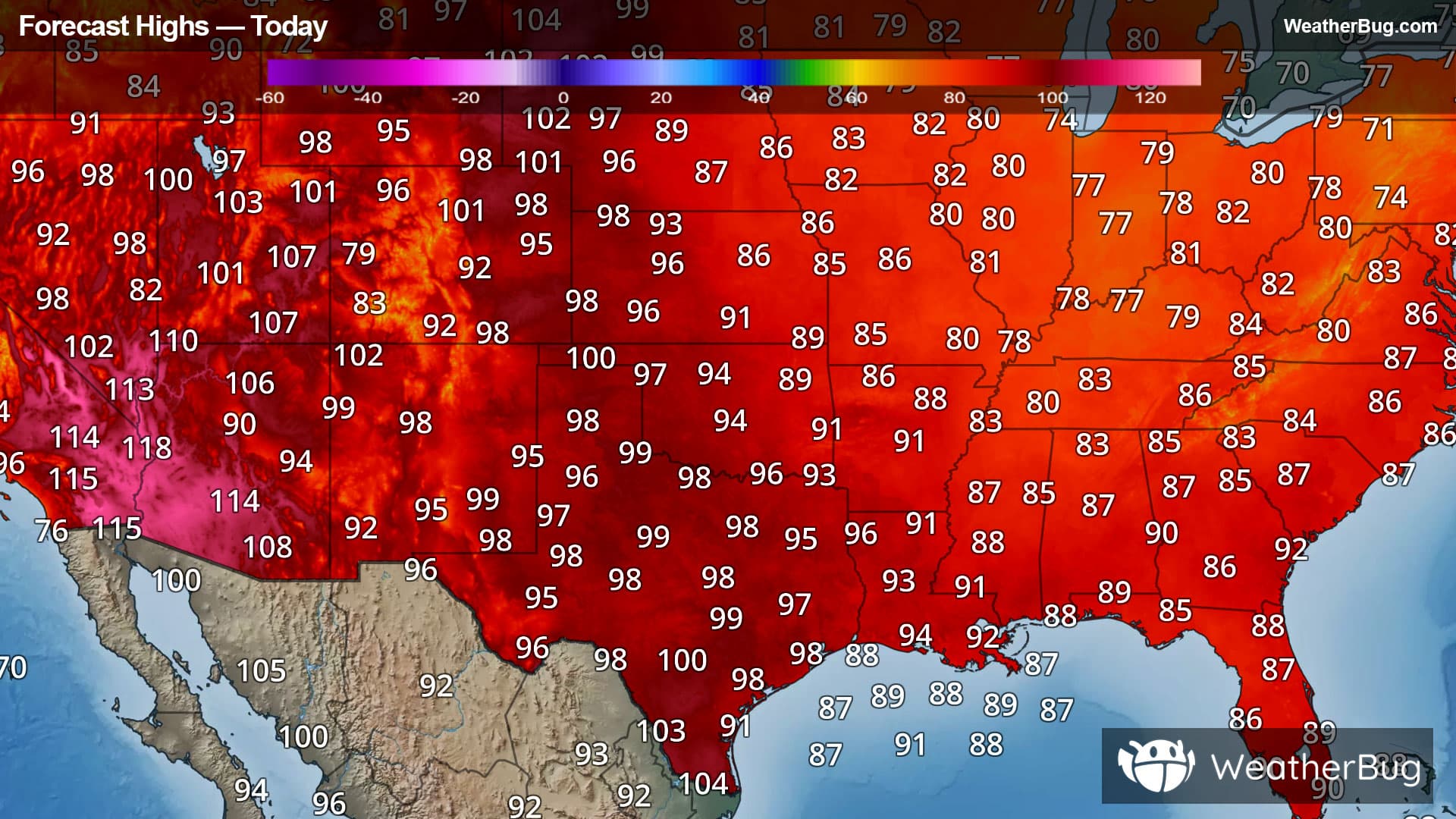
Dwight, IL Weather

As of

Weather Station:PONTIAC

Open weather station selector modal

16degrees Fahrenheit

Feels like:0

Hi: 25Lo: 16

Partly Cloudy

Live Weather Radar

Dwight, IL weather radar map

Current Weather Details

Windchill
--
Daily Rain
--
Dew point
--
Monthly Rain
--
Humidity
--
Avg. Wind
--
Pressure
--
Wind Gust
--
Sunrise
7:16 AM
Moon
Waning Crescent
Sunset
4:52 PM
UV Index
1 (Low)

Weather Forecast

  • Tonight

    Lo

    Partly cloudy with a slight chance of snow. Chance of precipitation 30%. Low temperature around 19F. Dew point will be around 16F with an average humidity of 66%. Winds will be 12 mph from the W.

  • Tomorrow

    Hi

    Mostly cloudy. A slight chance of flurries in the morning then a slight chance of snow early in the afternoon. A chance of snow late. Little or no snow accumulation. Blustery. Near steady temperature around 19. West winds 10 to 15 mph increasing to 15 to 20 mph in the afternoon. Gusts up to 30 mph. Chance of precipitation 50 percent.

Dwight, IL 10-day weather forecast

AIR QUALITY

14 | Excellent

Top Triggers:pm25
Air quality data provided by Ambee
View Today's Air Quality details for Dwight, IL

POLLEN COUNT & ALLERGY FORECAST

0.1 Low

Predominant Pollen:None
View the Pollen forecast details

LIGHTNING MAP

Closest strike in the last 30 minutes:1706.2 miles

No Lightning Nearby

Real-time lightning alerts & live Map