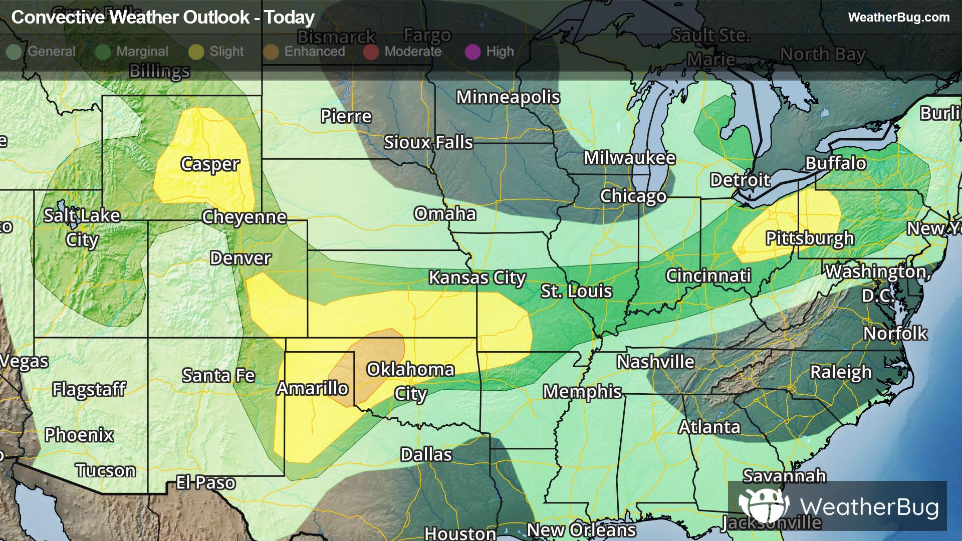
Central & Southern Plains Under Severe Threat
A low pressure system tracking across the central U.S. will produce severe thunderstorms over the southern Plains today.
Read More
73degrees Fahrenheit

Feels like:74°
Hi:80°Lo:64°
Partly Cloudy
Lo

Mostly cloudy. A chance of showers late. Lows in the lower 60s. Northeast winds around 5 mph. Chance of precipitation 40 percent.
Hi

A slight chance of thunderstorms in the morning. Showers. A chance of thunderstorms in the afternoon. Highs in the lower 70s. East winds 5 to 10 mph increasing to 10 to 15 mph in the afternoon. Chance of precipitation 80 percent.


Closest strike in the last 30 minutes:212.9 miles
No Lightning Nearby


