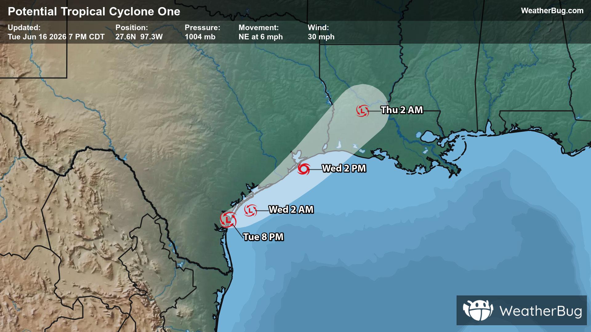
Potential Tropical Cyclone One May Become Atlantic's First Named Storm
A disorganized Potential Tropical Cyclone One may become the Atlantic season's first named storm on Wednesday.
Read More

70% Chance of Rain
Lo

Showers likely and a slight chance of thunderstorms. Lows in the mid 50s. Southeast winds 5 to 15 mph and gusty. Chance of rain 70 percent.
Hi

Showers likely in the morning then showers and a chance of thunderstorms in the afternoon. Highs 65 to 70. Breezy. West winds around 10 mph increasing to north around 20 mph in the afternoon. Chance of rain 90 percent.


Closest strike in the last 30 minutes:11.1 miles
Storms Approaching
A disorganized Potential Tropical Cyclone One may become the Atlantic season's first named storm on Wednesday.


