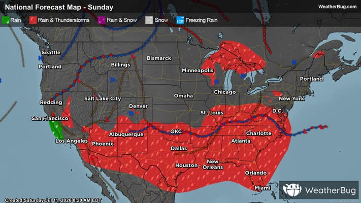
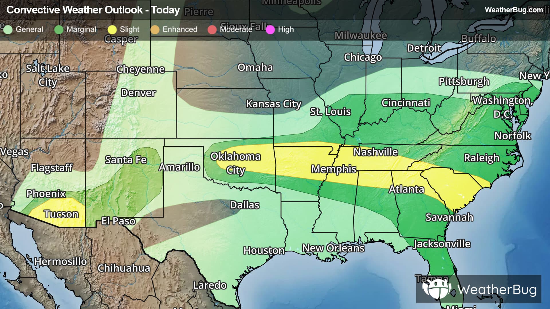
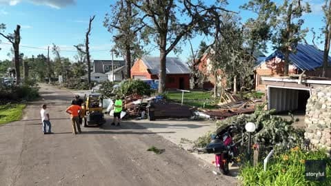
Ees, Drenthe, NL Weather

As of
Current Temperature
43

Feels like:35°

Today's high temperature
52°
Today's low temperature
43°

Current Weather Condition70% Chance Rain Showers

Live Weather Radar

Ees, Drenthe, NL weather radar map

Current Weather Details

Windchill
35°
Daily Rain
0"
Dew point
36°
Monthly Rain
--"
Humidity
76%
Avg. Wind
W 18 mph
Pressure
29.65" →
Wind Gust
18 mph
Sunrise
5:42 AM
Moon
Waning Crescent
Sunset
9:16 PM
UV Index
4 (Moderate)

Weather Forecast

  • Tonight

    Lo

    Mostly cloudy with probable rain. Chance of precipitation 75%. Low temperature around 43F. Dew point will be around 38F with an average humidity of 81%. Winds will be 14 mph from the NW.

  • Tomorrow

    Hi

    Mostly cloudy with a chance of rain. Chance of precipitation 60%. High temperature around 54F. Dew point will be around 34F with an average humidity of 60%. Winds will be 12 mph from the NW.

Ees, Drenthe, NL 10-day weather forecast

AIR QUALITY

Air Quality Index
29|Fair
Top Triggers:
pm25
View Today's Air Quality details for Ees, Drenthe, NL

POLLEN COUNT & ALLERGY FORECAST

Pollen Count
--|Not Available
Predominant Pollen:
View the Pollen forecast details

LIGHTNING MAP

Closest strike in the last 30 minutes:421.4 miles

No Lightning Nearby

Real-time lightning alerts & live Map