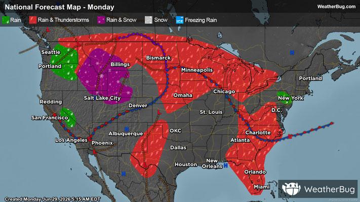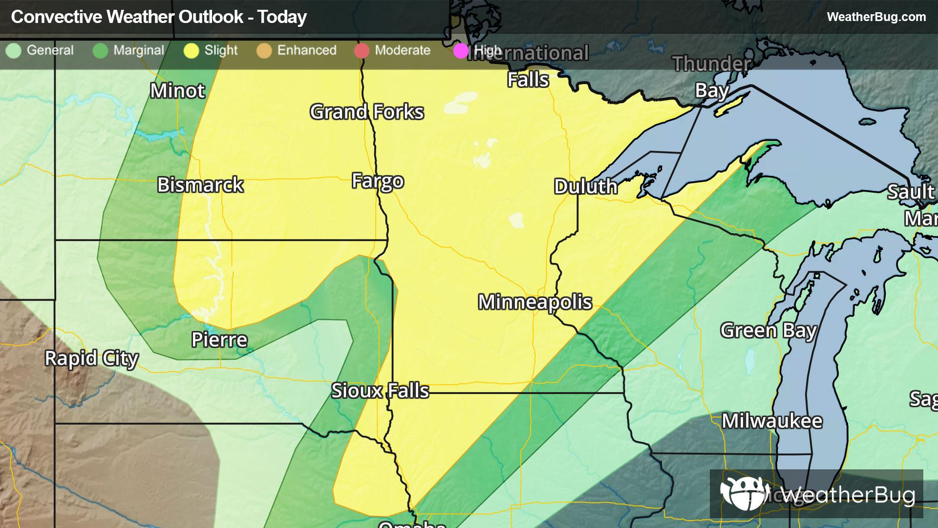
Severe Weather Underway For Northern Plains & Upper Midwest
A strengthening low pressure system will produce severe weather across the northern Plains and Upper Midwest today.
Read More
75degrees Fahrenheit

Feels like:75°
Hi:77°Lo:75°
Partly Cloudy
Lo

Partly cloudy. Lows in the mid 70s. South winds 5 to 10 mph with gusts up to 20 mph.
Hi

Mostly sunny. Humid with highs in the lower 90s. South winds 10 to 15 mph with gusts up to 25 mph. Heat index values up to 106.


Closest strike in the last 30 minutes:301.1 miles
No Lightning Nearby
A strengthening low pressure system will produce severe weather across the northern Plains and Upper Midwest today.