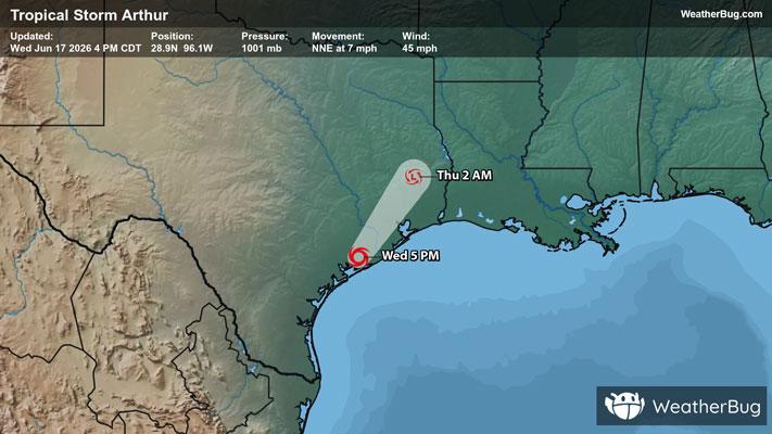
Severe Weather Outbreak Targets the Midwest
An outbreak of severe weather is expected across the Midwest today, including the risk for intense tornadoes.
Read More
61degrees Fahrenheit

Feels like:61°
Hi:63°Lo:54°
80% Chance of Light Rain
Hi

Cloudy with likely rain. Chance of precipitation 100%. High temperature around 63F. Dew point will be around 55F with an average humidity of 94%. Winds will be 10 mph from the SE.
Lo

Mostly cloudy. Rain showers likely and chance of thunderstorms early in the evening then slight chance of rain showers late in the evening. Some thunderstorms may be severe with damaging winds and large hail. Lows in the lower 50s. Northwest winds 5 to 15 mph. Chance of precipitation 60 percent.

Closest strike in the last 30 minutes:57.5 miles
No Lightning Nearby
An outbreak of severe weather is expected across the Midwest today, including the risk for intense tornadoes.