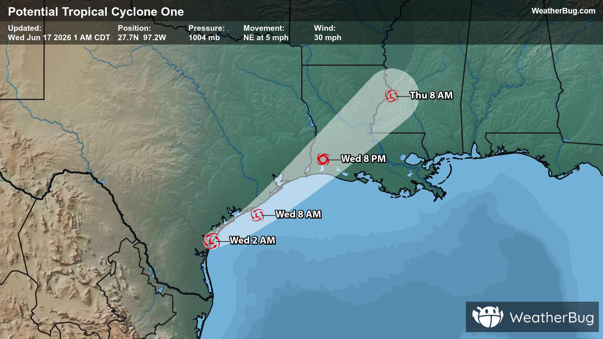
Potential Tropical Cyclone One May Become Atlantic's First Named Storm
A disorganized Potential Tropical Cyclone One may become the Atlantic season's first named storm today.
Read More

Mostly Cloudy
Lo

Mostly cloudy. A slight chance of showers. Near steady temperature in the lower 70s. Southeast winds around 5 mph. Chance of rain 20 percent.
Hi

Partly sunny. A chance of showers and thunderstorms in the morning then showers and thunderstorms likely in the afternoon. Some thunderstorms may produce heavy rainfall. Humid with highs in the mid 80s. South winds 10 to 15 mph with gusts up to 25 mph. Chance of rain 60 percent.


Closest strike in the last 30 minutes:102.8 miles
No Lightning Nearby
A disorganized Potential Tropical Cyclone One may become the Atlantic season's first named storm today.


