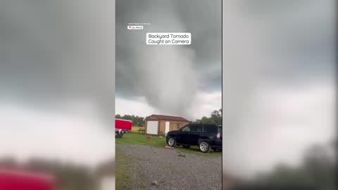
Everly, IA Weather

As of

Weather Station:SPENCER

Open weather station selector modal

16degrees Fahrenheit

Feels like:-7°F

Hi: 32Lo: 0

Windy

Live Weather Radar

Everly, IA weather radar map

Current Weather Details

Windchill
-7°
Daily Rain
0.48"
Dew point
13°
Monthly Rain
0.77"
Humidity
88%
Avg. Wind
NNW 40 mph
Pressure
29.97" →
Wind Gust
58 mph
Sunrise
7:33 AM
Moon
Waning Crescent
Sunset
7:27 PM
UV Index
3 (Moderate)

Weather Forecast

  • Tonight

    Lo

    Cloudy with a chance of snow this evening then partly cloudy after midnight. Blowing snow. Visibility one quarter mile or less at times. Snow accumulation around an inch possible. Very windy and much colder with lows around 2 below. Northwest winds 35 to 45 mph with gusts up to 60 mph diminishing to 30 to 35 mph with gusts up to 50 mph after midnight. Chance of snow 50 percent. Wind chill values as low as 28 below.

  • Tomorrow

    Hi

    Sunny. Areas of blowing snow in the morning then patchy blowing snow in the afternoon. Windy and much colder with highs around 11. Northwest winds 20 to 30 mph. Gusts up to 45 mph in the morning. Wind chill values as low as 29 below.

Everly, IA 10-day weather forecast

AIR QUALITY

21 | Fair

Top Triggers:pm25
Air quality data provided by Ambee
View Today's Air Quality details for Everly, IA

POLLEN COUNT & ALLERGY FORECAST

0.6 Low

Predominant Pollen:Cedar/Juniper
View the Pollen forecast details

LIGHTNING MAP

Closest strike in the last 30 minutes:381.5 miles

No Lightning Nearby

Real-time lightning alerts & live Map