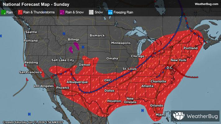
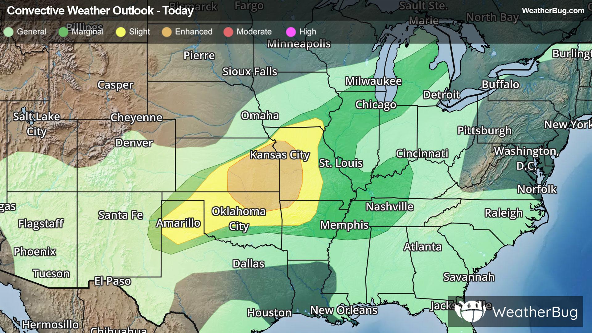
Fredonia, NY Weather

As of

Weather Station:WeatherBug

Open weather station selector modal

18degrees Fahrenheit

Feels like:0

Hi: 24Lo: 11

70% Chance of Flurries

Live Weather Radar

Fredonia, NY weather radar map

Current Weather Details

Windchill
-0°
Daily Rain
--"
Dew point
12°
Monthly Rain
2.47"
Humidity
80%
Avg. Wind
WSW 24 mph
Pressure
--"
Wind Gust
-- mph
Sunrise
7:42 AM
Moon
Waxing Crescent
Sunset
5:14 PM
UV Index
1 (Low)

Weather Forecast

  • Today

    Hi

    Mostly cloudy with probable snow. Chance of precipitation 70%. High temperature around 25F. Dew point will be around 16F with an average humidity of 81%. Winds will be 19 mph from the W.

  • Tonight

    Lo

    Snow early then snow showers likely late this evening. A chance of snow showers after midnight then snow showers likely late. Areas of blowing snow. Snow may be heavy at times early with visibility one quarter mile or less at times. Additional accumulation 3 to 6 inches. Very windy and cold with lows ranging from zero to 5 above in interior valleys to 5 to 10 above along the lake erie shore. West winds 25 to 35 mph with gusts up to 45 mph diminishing to 15 to 30 mph. Chance of snow near 100 percent. Wind chill values as low as 15 below.

Fredonia, NY 10-day weather forecast

AIR QUALITY

20 | Fair

Top Triggers:pm25
Air quality data provided by Ambee
View Today's Air Quality details for Fredonia, NY

POLLEN COUNT & ALLERGY FORECAST

0.1 Low

Predominant Pollen:None
View the Pollen forecast details

LIGHTNING MAP

Closest strike in the last 30 minutes:1961.6 miles

No Lightning Nearby

Real-time lightning alerts & live Map