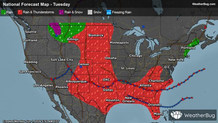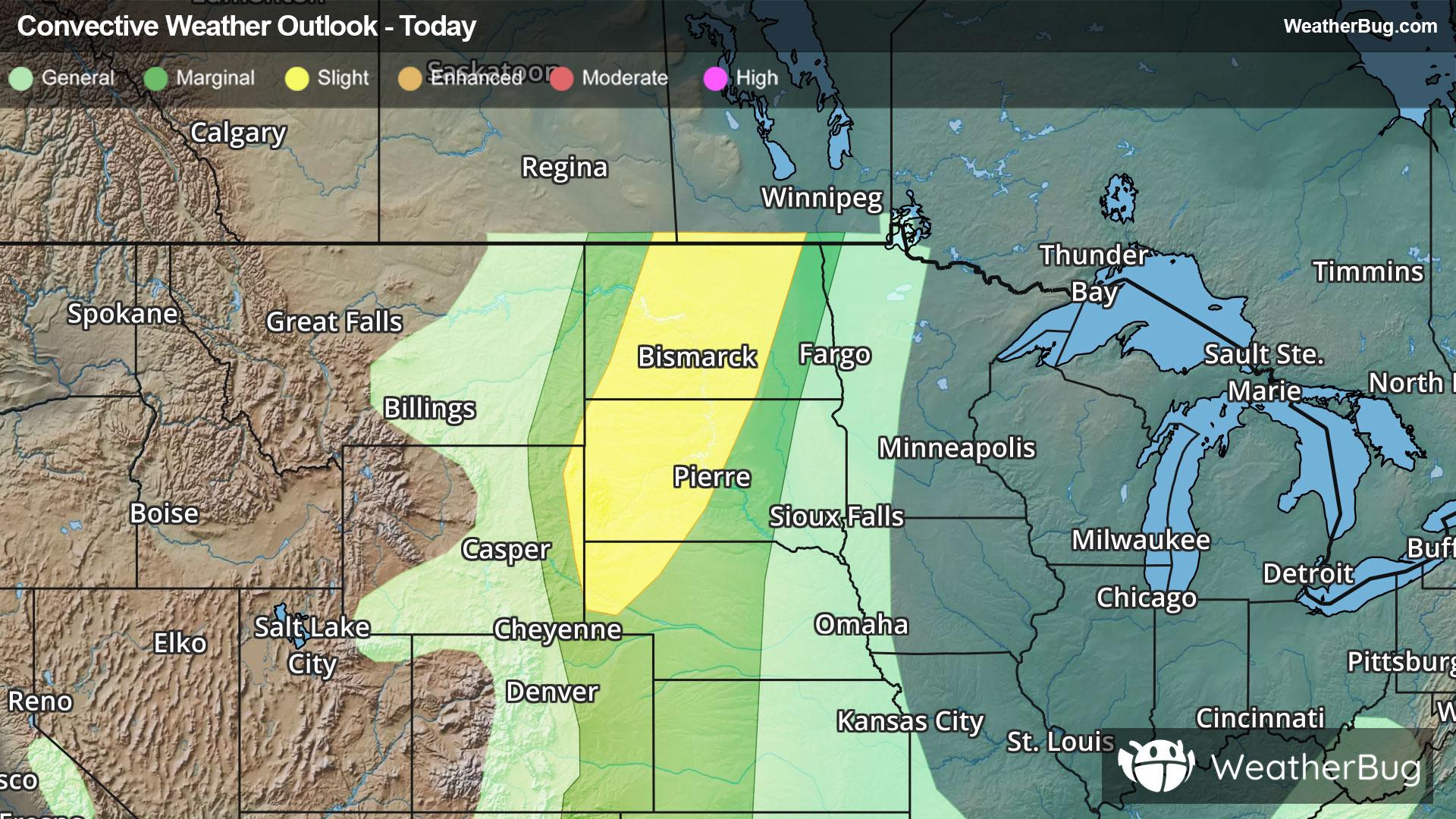
Severe Storms Form Across The Northern Plains
An area of strong to severe thunderstorms will develop across the northern Plains this afternoon and evening.
Read More

Feels like:79°
Current Weather ConditionPartly Cloudy
Hi

Mostly cloudy. Highs in the lower 80s. Southeast winds 5 to 10 mph increasing to south 15 to 20 mph.
Lo

Partly cloudy in the evening then becoming mostly cloudy. Lows in the upper 50s. South winds 10 to 15 mph with gusts up to 30 mph.


Closest strike in the last 30 minutes:241.6 miles
No Lightning Nearby