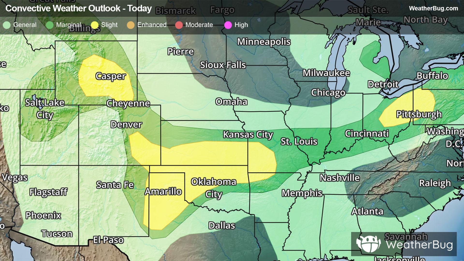
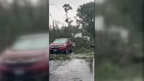
Central & Southern Plains Under Severe Threat
A low pressure system tracking across the central U.S. will produce severe thunderstorms over the southern Plains today.
Read More
85degrees Fahrenheit

Feels like:88°
Hi:85°Lo:68°
30% Chance Rain Showers
Hi

Mostly cloudy with a chance of showers and thunderstorms. Some thunderstorms may produce heavy rainfall. Near steady temperature in the mid 80s. West winds around 5 mph. Chance of rain 50 percent.
Lo

Mostly cloudy with a chance of thunderstorms. A chance of showers in the evening then showers likely after midnight. Some thunderstorms may produce heavy rainfall. Lows in the upper 60s. East winds around 5 mph becoming southeast after midnight. Chance of rain 70 percent.

Closest strike in the last 30 minutes:24.0 miles
Monitor Storms


