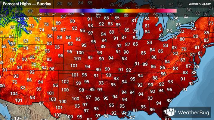
Storms Bring Flood and Severe Risk from High Plains to Carolinas
Two low pressure systems will bring severe weather to the High Plains and Carolinas today.
Read More
76degrees Fahrenheit

Feels like:76°
Hi:83°Lo:71°
70% Chance Rain Showers
Lo

Partly cloudy with a slight chance of showers and thunderstorms this evening then mostly cloudy with a chance of showers and thunderstorms after midnight. Patchy fog after midnight. Lows around 70. Southeast winds around 5 mph. Chance of rain 50 percent.
Hi

Mostly sunny. A slight chance of showers and thunderstorms in the morning. Patchy fog in the morning. Humid with highs in the lower 90s. South winds 5 to 10 mph. Chance of rain 20 percent. Heat index values up to 105 in the afternoon.


Closest strike in the last 30 minutes:195.1 miles
No Lightning Nearby
Two low pressure systems will bring severe weather to the High Plains and Carolinas today.