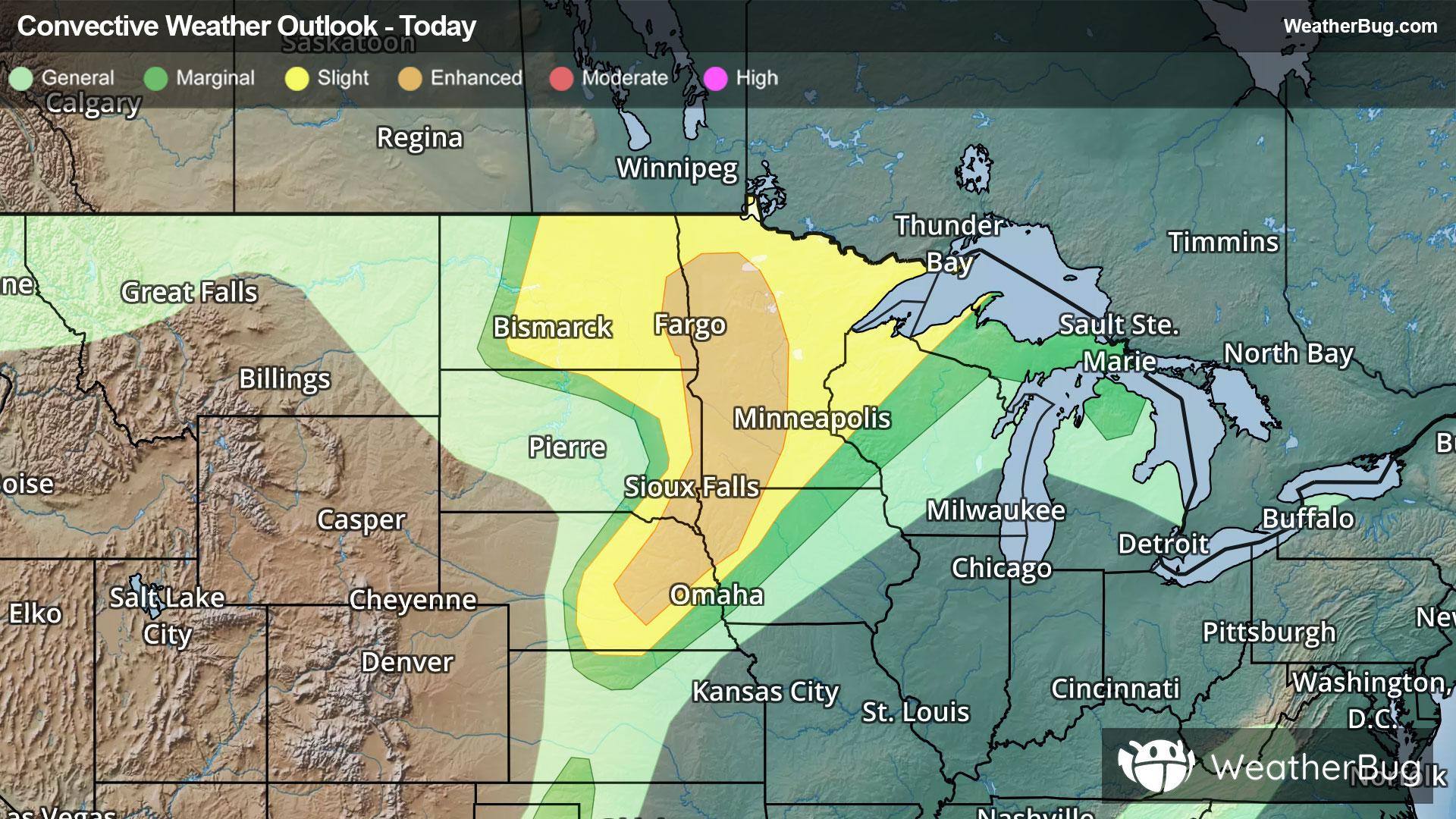
Dangerous Storms Underway For Northern Plains & Upper Midwest
A strengthening low pressure system will produce severe weather across the northern Plains and Upper Midwest tonight.
Read More
77degrees Fahrenheit

Feels like:77°
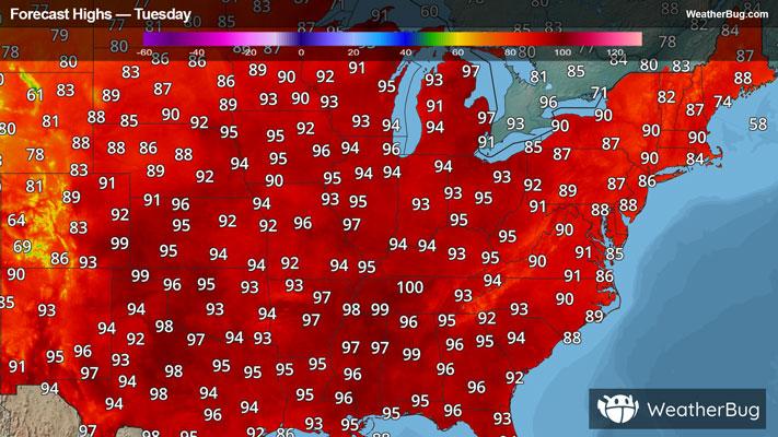
Hi:93°Lo:73°
50% Chance of Storms
Lo

Partly cloudy then becoming mostly cloudy late in the evening then becoming partly cloudy then becoming mostly cloudy late in the night. Chance of thunderstorms in the evening then slight chance of showers after midnight. Some thunderstorms may be severe with damaging winds and large hail. Lows in the upper 60s. Southwest winds 5 to 15 mph. Gusts up to 35 mph in the evening. Chance of precipitation 50 percent.
Hi

Sunny. Highs around 90. Southwest winds 5 to 15 mph.

Closest strike in the last 30 minutes:23.0 miles
Monitor Storms
A strengthening low pressure system will produce severe weather across the northern Plains and Upper Midwest tonight.