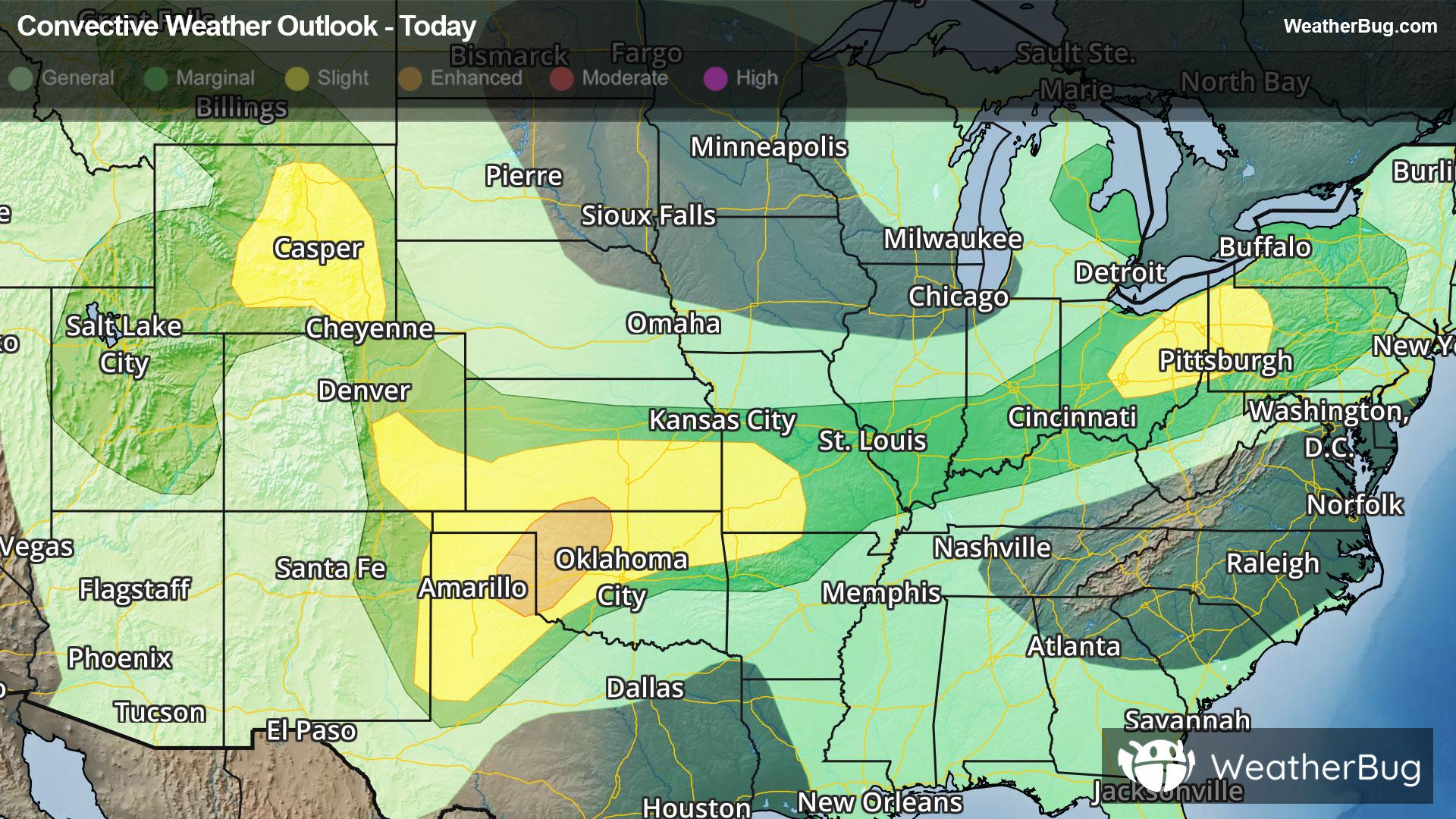
Heisson, WA Weather

As of

Weather Station:PF&R Station 22

Open weather station selector modal

47degrees Fahrenheit

Feels like:44°F

Hi: 47Lo: 34

40% Chance of Light Rain

Live Weather Radar

Heisson, WA weather radar map

Current Weather Details

Windchill
37°
Daily Rain
--"
Dew point
37°
Monthly Rain
0.91"
Humidity
84%
Avg. Wind
SW 6 mph
Pressure
--"
Wind Gust
-- mph
Sunrise
7:34 AM
Moon
Waning Gibbous
Sunset
7:07 PM
UV Index
2 (Low)

Weather Forecast

  • Today

    Hi

    Mostly cloudy. A chance of rain early then rain showers with a slight chance of thunderstorms. Highs in the mid 40s. Southwest wind 5 to 10 mph. Chance of rain 80 percent. Rainfall amounts around a tenth of an inch except higher amounts possible in thunderstorms.

  • Tonight

    Lo

    Rain likely. A slight chance of thunderstorms and snow in the evening then a chance of snow after midnight. Patchy fog after midnight. Snow level 1000 feet. No snow accumulation. Lows in the lower 30s. West wind 5 to 10 mph becoming light after midnight. Chance of precipitation 70 percent. Rainfall amounts around a tenth of an inch.

Heisson, WA 10-day weather forecast

AIR QUALITY

17 | Excellent

Top Triggers:pm25
Air quality data provided by Ambee
View Today's Air Quality details for Heisson, WA

POLLEN COUNT & ALLERGY FORECAST

2.8 Low-Medium

Predominant Pollen:Cedar/Juniper, Hazelnut and Elm
View the Pollen forecast details

LIGHTNING MAP

Closest strike in the last 30 minutes:1356.8 miles

No Lightning Nearby

Real-time lightning alerts & live Map