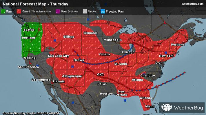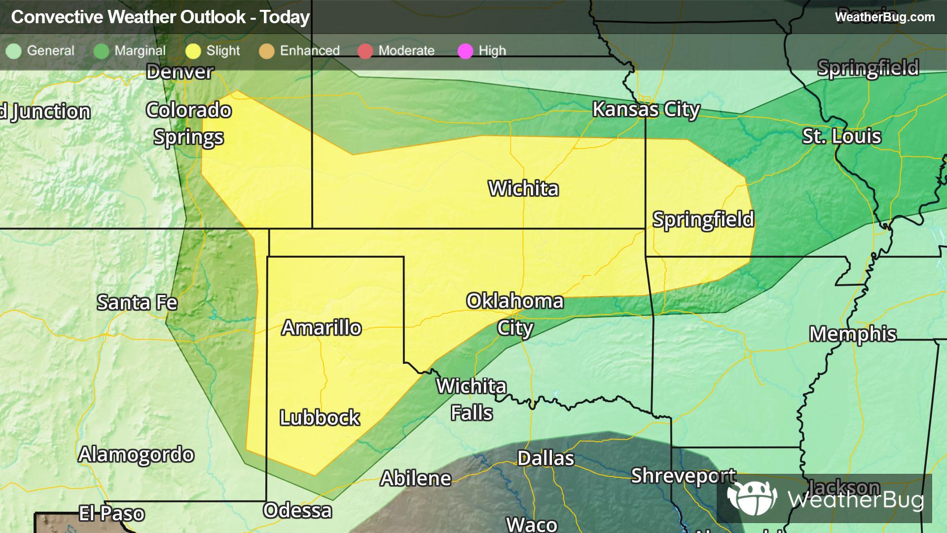
Central & Southern Plains Under Severe Threat
A low pressure system tracking across the central U.S. will produce severe thunderstorms over the southern Plains today.
Read More
73degrees Fahrenheit

Feels like:73°
Hi:86°Lo:71°
70% Chance of Rain
Hi

Mostly cloudy this morning then becoming partly sunny. Patchy fog this morning. A chance of showers. A slight chance of thunderstorms this morning then a chance of thunderstorms this afternoon. Some thunderstorms may produce heavy rainfall this morning. Some thunderstorms may produce heavy rainfall this afternoon. Highs in the upper 80s. Southeast winds 10 to 15 mph with gusts up to 25 mph. Chance of rain 50 percent.
Lo

Showers likely with a chance of thunderstorms in the evening then a chance of showers with a slight chance of thunderstorms after midnight. Some thunderstorms may produce heavy rainfall. Humid with lows in the upper 60s. South winds 10 to 15 mph. Chance of rain 70 percent.


Closest strike in the last 30 minutes:9.6 miles
Stay Alert!