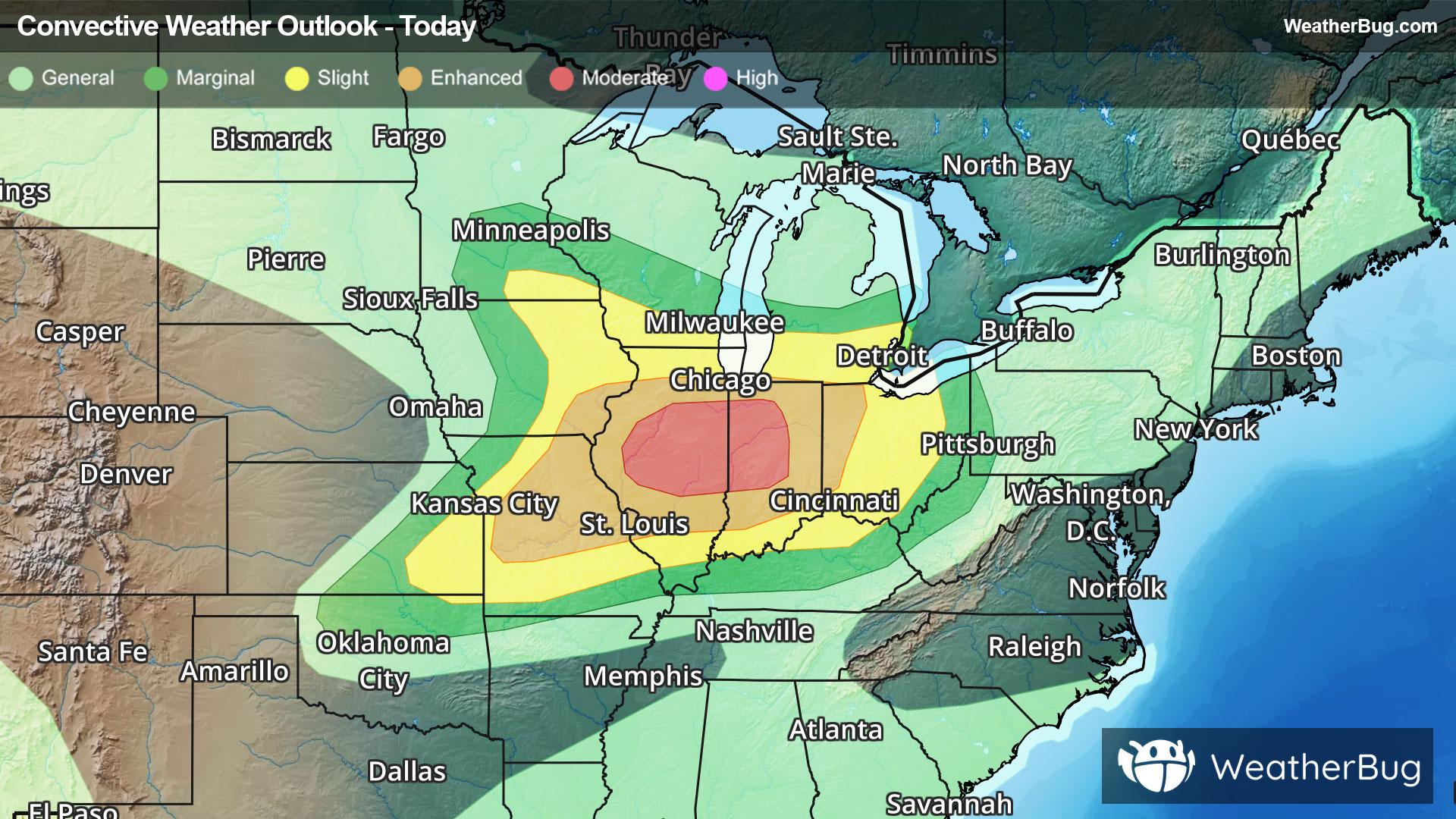
Severe Weather Outbreak Targets the Midwest
An outbreak of severe weather is expected across the Midwest today, including the risk for intense tornadoes.
Read More

Mostly Cloudy
Hi

Partly cloudy early then becoming mostly cloudy. Showers with a chance of thunderstorms. Near steady temperature in the lower 70s. Southwest winds around 10 mph becoming south 15 to 20 mph with gusts up to 30 mph. Chance of rain 90 percent.
Lo

Cloudy with showers with thunderstorms likely in the evening then partly cloudy with a chance of showers and thunderstorms after midnight. Some thunderstorms may be severe in the evening. Locally heavy rainfall possible in the evening. Breezy with lows in the lower 60s. South winds 20 to 25 mph becoming southwest 15 to 25 mph after midnight. Gusts up to 40 mph. Chance of rain 90 percent.

Closest strike in the last 30 minutes:177.5 miles
No Lightning Nearby