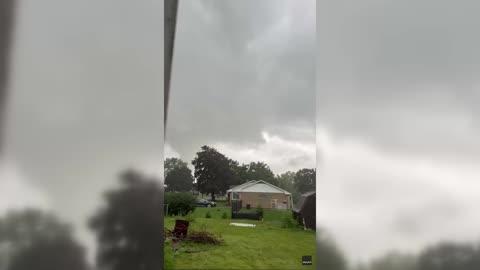
Kaneohe, HI Weather

As of

Weather Station:WeatherBug

Open weather station selector modal

72degrees Fahrenheit

Feels like:72°F

Hi: 75Lo: 72

Partly Cloudy

Live Weather Radar

Kaneohe, HI weather radar map

Current Weather Details

Windchill
72°
Daily Rain
--"
Dew point
66°
Monthly Rain
--"
Humidity
86%
Avg. Wind
SSE 2 mph
Pressure
--"
Wind Gust
-- mph
Sunrise
6:44 AM
Moon
Third Quarter
Sunset
6:39 PM
UV Index
8 (Very High)

Weather Forecast

  • Today

    Hi

    Mostly cloudy. Haze in the morning. Showers and isolated thunderstorms in the morning then scattered showers and isolated thunderstorms in the afternoon. Locally heavy rainfall possible. Highs 72 to 83. Southeast winds 10 to 15 mph. Chance of rain 80 percent.

  • Tonight

    Lo

    Breezy. Mostly cloudy with frequent showers and isolated thunderstorms. Locally heavy rainfall possible. Lows 63 to 73. South winds 10 to 20 mph. Chance of rain 80 percent.

Kaneohe, HI 10-day weather forecast

AIR QUALITY

28 | Fair

Top Triggers:pm25
Air quality data provided by Ambee
View Today's Air Quality details for Kaneohe, HI

POLLEN COUNT & ALLERGY FORECAST

-- Not Available

Predominant Pollen:--
View the Pollen forecast details

LIGHTNING MAP

Closest strike in the last 30 minutes:615.7 miles

No Lightning Nearby

Real-time lightning alerts & live Map